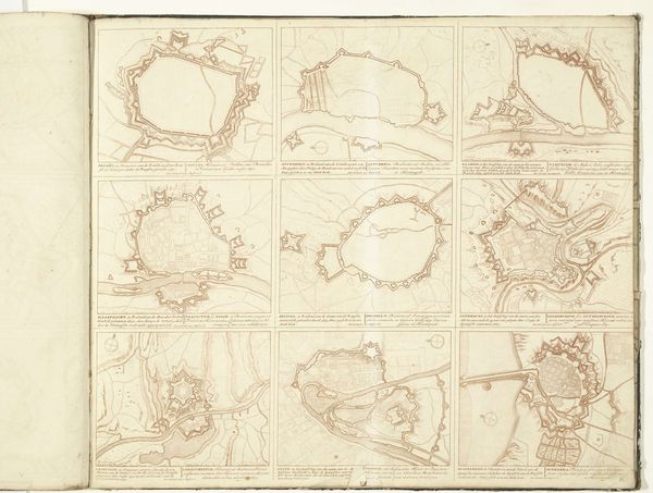
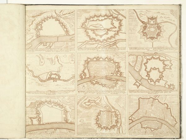
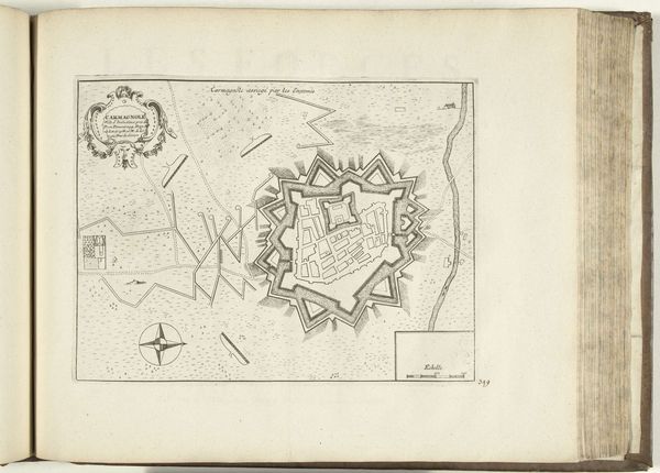
Vestingplattegrond van Maubeuge, Le Quesnoy, Aat en Condé-sur-l'Escaut c. 1700 - 1710
0:00
0:00
anonymous
Rijksmuseum
graphic-art, print, engraving
#
graphic-art
#
baroque
#
pen drawing
# print
#
geometric
#
cityscape
#
engraving
Dimensions: height 495 mm, width 582 mm
Copyright: Rijks Museum: Open Domain
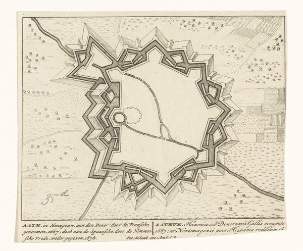
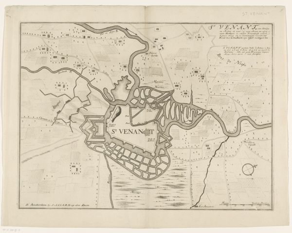
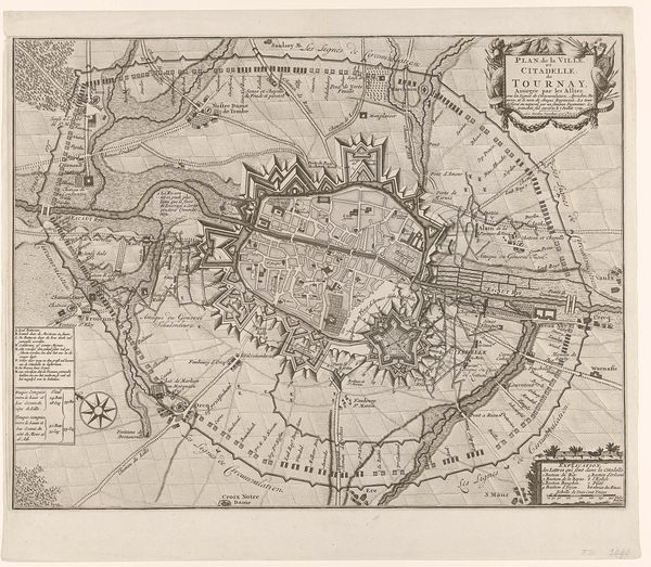
This print, of unknown date and authorship, shows fortifications in the cities of Maubeuge, Le Quesnoy, Aat, and Condé-sur-l'Escaut. It’s made from ink on paper, a relatively inexpensive and easily reproducible material. The process of etching or engraving, by which these maps would have been made, is labor-intensive. Each line is carefully incised into a metal plate, which is then inked and pressed onto paper. Look closely, and you can see the incredible detail achieved through this method: the intricate patterns of the fortifications, the tiny buildings within the city walls, even the subtle shading of the landscape. The very existence of this print speaks to the increasing importance of military strategy and urban planning. It reflects the rise of centralized states and the growing demand for accurate information about territory and resources. The print medium allowed for the widespread dissemination of knowledge, contributing to the development of new strategies of war and control. Considering its material and process, this print is a testament to the value of information in a rapidly changing world. It reminds us that even seemingly simple objects can be deeply embedded in social and political contexts.
Comments
No comments
Be the first to comment and join the conversation on the ultimate creative platform.
More like this