print, engraving
#
baroque
#
dutch-golden-age
# print
#
landscape
#
cityscape
#
engraving
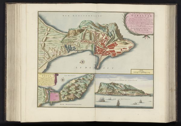
Dimensions: height 182 mm, width 463 mm
Copyright: Rijks Museum: Open Domain
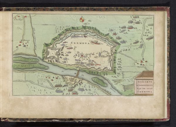
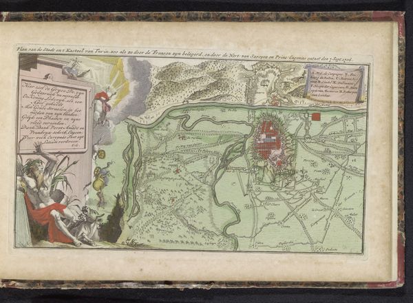
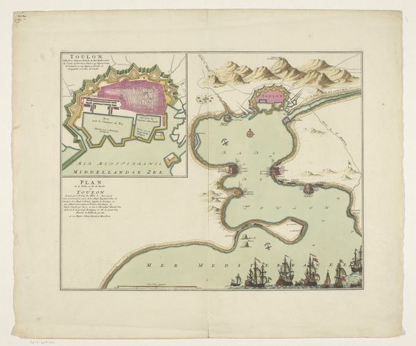
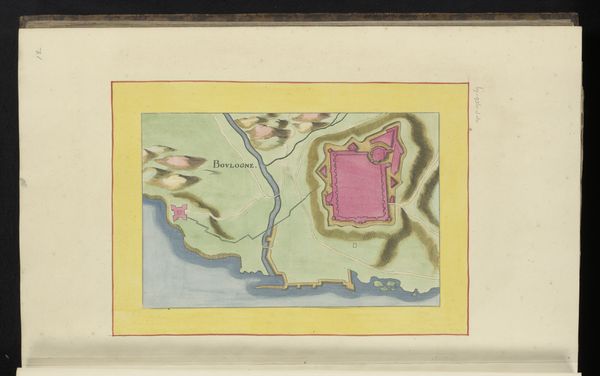
This map of Gibraltar was made anonymously using engraving, likely in the 17th or 18th century. The linear precision achieved through engraving allows for incredible detail, essential for cartography. The process begins with an artist using a tool called a burin to carve lines directly into a metal plate, usually copper. Ink is then applied to the plate, filling the etched lines. The surface is wiped clean, and the image is transferred to paper under high pressure. This map would have required exceptional skill in both drawing and handling the burin, and a mastery of the printing press. Consider how the sharp, definitive lines of the engraving lend an air of authority and accuracy to the map. This precision would have been highly valued for navigation and military strategy. The coloring, though applied later, highlights key features and adds to the map's visual appeal. Ultimately, this map is a testament to the engraver's meticulous craft and the crucial role of printmaking in disseminating knowledge and power during a period of exploration and conflict. It reminds us that even seemingly functional objects can be appreciated for their artistry and the complex social context in which they were made.
Comments
No comments
Be the first to comment and join the conversation on the ultimate creative platform.
More like this