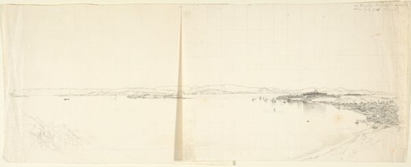
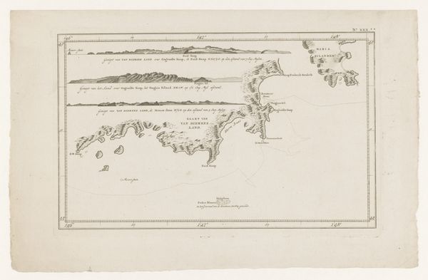
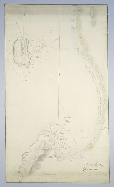
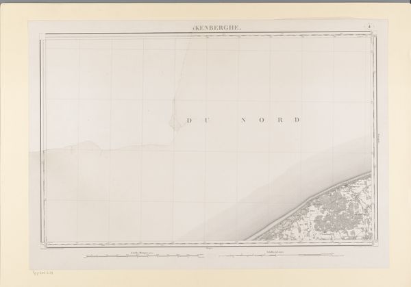
Map of the Coast from Saldanha Bay to Richard’s Bay, with a detailed map of Mossel Bay inserted c. 1777 - 1778
0:00
0:00
#
aged paper
#
homemade paper
#
water colours
#
hand drawn type
#
fading type
#
stylized text
#
watercolour bleed
#
watercolour illustration
#
watercolor
#
historical font
Dimensions: height 790 mm, width 1003 mm
Copyright: Rijks Museum: Open Domain
Editor: So, this is Robert Jacob Gordon’s "Map of the Coast from Saldanha Bay to Richard’s Bay, with a detailed map of Mossel Bay inserted," dating from around 1777 to 1778. The watercolour illustrations have this incredible delicacy, and the homemade paper has aged beautifully. It's a detailed coastline, but more than a purely functional document, wouldn’t you say? How do you interpret its symbolism, or perhaps its emotional weight? Curator: Absolutely. It's more than just lines on paper, isn't it? Think about the symbols employed. Water itself is transformation, exploration. Maps were powerful ideological tools. The imposition of grids and the naming of places? Those are acts of claiming, acts heavy with cultural significance. Editor: Claiming, yes. So the map isn't neutral; it’s an assertion of… control? Curator: Precisely! Maps dictate relationships between those with power to commission them and the land/its inhabitants, a form of visual rhetoric. What kind of visual symbols jump out at you? Editor: The compass rose, and the stylistic, if faded, text feel very deliberate, as if to emphasize accuracy and sophistication in a style accessible to educated people of the time. It's projecting a very confident, European vision. Curator: Exactly. Now think about what isn't shown. The people already living there? They are, effectively, erased, culturally bypassed. And notice that detailed insertion. Mossel Bay becomes a focal point, signifying importance for… whom? Editor: Ah, yes. I'm learning how much is packed into these early cartographies! So the next time I study maps, I will look more at not only the content, but also at how it symbolizes power structures, not purely about directions, which, really, redefines everything I think of navigation now. Curator: Glad it provided new direction to your perception! Now you can see a whole other dimension.
Comments
No comments
Be the first to comment and join the conversation on the ultimate creative platform.
More like this