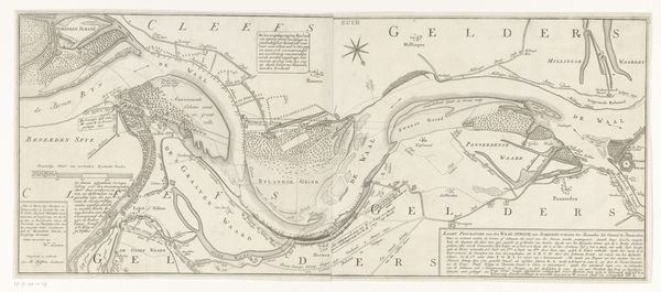
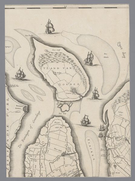
Kaart met het kanaal tussen de Nederrijn en de Waal bij Pannerden 1718 - 1727
0:00
0:00
anonymous
Rijksmuseum
print, engraving
#
dutch-golden-age
# print
#
landscape
#
geometric
#
engraving
Dimensions: height 335 mm, width 247 mm
Copyright: Rijks Museum: Open Domain
This is an anonymous map, made with pen and ink, depicting the canal between the Lower Rhine and the Waal near Pannerden. Maps like this played a vital role in shaping social and economic structures in the Netherlands. The waterways were crucial for trade, transportation, and defense. This map isn't just a geographical document; it's a statement of control and understanding of the landscape. It reflects the Dutch Republic's efforts to manage and exploit its environment for commercial and military advantage. You can see how settlements are marked along the rivers, indicating the economic importance of these routes. The precise rendering suggests an intention to make hydro-engineering and water management legible and perhaps controllable. To understand this map fully, we would need to delve into the archives of the Dutch water boards, and consult historical records of trade and military campaigns. The meaning of this map is shaped by its historical context, revealing the intricate relationship between society, institutions, and the environment.
Comments
No comments
Be the first to comment and join the conversation on the ultimate creative platform.
More like this