print, paper, engraving
# print
#
paper
#
geometric
#
academic-art
#
engraving
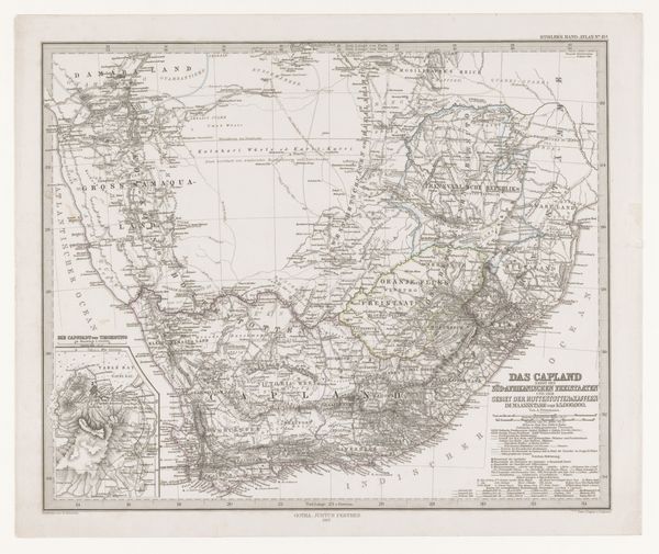
Dimensions: height 371 mm, width 446 mm
Copyright: Rijks Museum: Open Domain
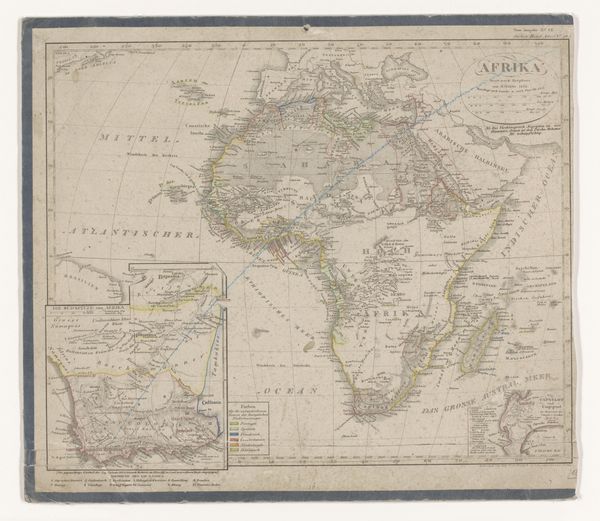
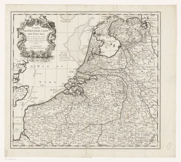
This is an old map of South Africa with the former Cape Colony made anonymously using ink on paper. The composition is dominated by the geographic forms of the land, articulated through delicate linework and subtle color washes. The coastline curves dramatically, creating a strong visual rhythm. Notice how the map’s structure employs a grid system, a framework for organizing space that aligns with the period's scientific approach to understanding and controlling the world. The use of different colors to delineate regions isn't just descriptive; it's a semiotic system that encodes political and cultural information. The map thus becomes a site where power relations are visually inscribed, revealing as much about the cartographer’s intentions as about the territory itself. The stark contrast between the detailed Cape Colony and the less defined interior suggests a colonial gaze, emphasizing control and knowledge. It is not just a depiction of land; it’s a statement about claiming and knowing.
Comments
No comments
Be the first to comment and join the conversation on the ultimate creative platform.
More like this