Dimensions: height 605 mm, width 730 mm
Copyright: Rijks Museum: Open Domain
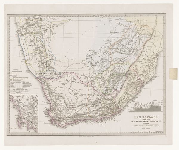
Carl Jungmann created this map of South Africa sometime in the 19th century, using ink on paper. Look closely, and you’ll see that the map is not just drawn, but engraved. The precision of the lines suggests a skilled hand wielding a burin, carefully incising the image into a metal plate, which was then inked and printed. Notice the fine details – the rivers, mountains, and settlements, all meticulously rendered. Mapmaking, of course, was essential to colonialism. So in that sense, the map represents more than geographic data. The map is a product of labor. From the surveyors who gathered the information to the engraver who transferred it to paper, this object embodies a complex web of social and economic relationships. As you consider its intricate details, remember that it is not just a representation of space, but of power.
Comments
No comments
Be the first to comment and join the conversation on the ultimate creative platform.
More like this