lithograph, print, paper
#
16_19th-century
#
lithograph
# print
#
paper
#
geometric
#
orientalism
Dimensions: height 522 mm, width 353 mm
Copyright: Rijks Museum: Open Domain
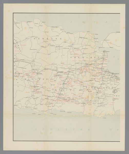
J.W. Stemfoort created this map of the Medan area to visualize the railway lines in Deli. This map serves as a visual document of Dutch colonial power and its impact on the landscape and society of Deli, in Sumatra. The railway lines depicted weren't just about transportation; they were tools to extract resources like tobacco and rubber. These resources were cultivated on plantations that relied on the forced labor of indigenous people and imported workers. Notice how the map meticulously charts the infrastructure facilitating the exploitation of resources, while likely disregarding indigenous land claims. The map creates a narrative of progress and control, masking the social and environmental costs of colonialism. Consider how this seemingly neutral cartographic representation plays a role in legitimizing colonial expansion and control, impacting the identities and livelihoods of those living in the mapped territories. It's a stark reminder of how maps can be instruments of power, shaping perceptions and reinforcing societal inequalities.
Comments
No comments
Be the first to comment and join the conversation on the ultimate creative platform.
More like this