graphic-art, print, paper
#
graphic-art
#
dutch-golden-age
# print
#
landscape
#
paper
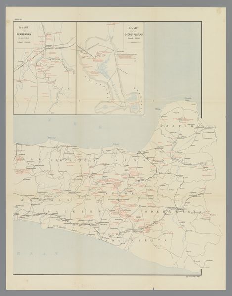
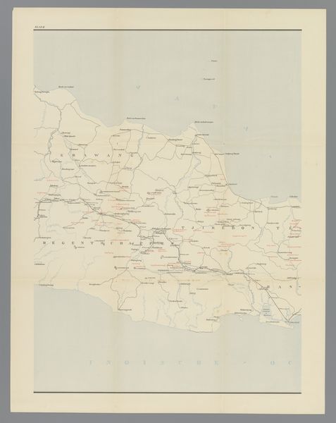
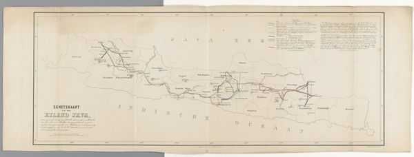
Dimensions: height 592 mm, width 491 mm
Copyright: Rijks Museum: Open Domain
This is a map of East Java, made by an anonymous cartographer. It’s printed on paper, a relatively new technology at the time of its creation. The precision of the lines and text suggests a mechanized process, likely involving an printing press and meticulous engraving. Unlike hand-drawn maps, this one relies on industrial techniques for mass production and distribution. The choice of paper as a medium also speaks to its intended use, that is for dissemination and practical application. The very act of mapping is tied to the expansion of territory and governance. Consider the labor involved, from the surveyors who gathered the geographic information to the printers who reproduced it. By examining the materials and production methods, we gain insight into the social and economic forces at play during its creation. This map transcends its practical function, it becomes a cultural artifact, reflecting the relationship between art, industry, and society.
Comments
No comments
Be the first to comment and join the conversation on the ultimate creative platform.
More like this