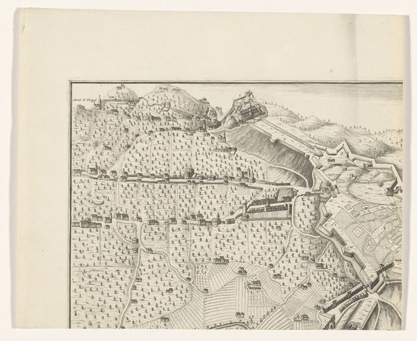
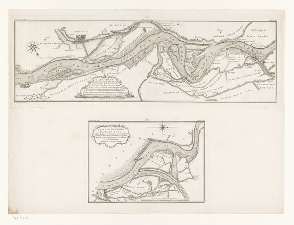
Kaart van de blokkade van Amsterdam door de troepen van Willem II, 1650 1728 - 1730
0:00
0:00
anonymous
Rijksmuseum
drawing, print, ink, engraving
#
drawing
#
dutch-golden-age
# print
#
landscape
#
ink line art
#
ink
#
geometric
#
cityscape
#
history-painting
#
academic-art
#
engraving
Dimensions: height 287 mm, width 515 mm
Copyright: Rijks Museum: Open Domain
This map illustrates the blockade of Amsterdam by the troops of William II, Prince of Orange in 1650. Created anonymously, it captures a pivotal moment of political tension in the Dutch Republic. During this era, the Netherlands was a society shaped by class divisions and regional identities. William II's attempt to seize control was met with resistance from the powerful merchant class of Amsterdam. The map reflects these tensions and the struggle for power between the central government and the city. Consider that a map is not a neutral document, but a declaration of power. Its emotional impact is evident in the way it frames Amsterdam, caught in a power struggle that would influence the nation’s future. This cartographic representation serves as a reminder of the intricate interplay between political ambition and civic identity.
Comments
No comments
Be the first to comment and join the conversation on the ultimate creative platform.
More like this