drawing, print, ink, engraving
#
drawing
#
dutch-golden-age
# print
#
landscape
#
ink
#
geometric
#
history-painting
#
engraving
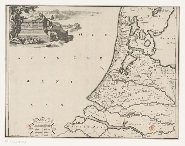
Dimensions: height 232 mm, width 300 mm
Copyright: Rijks Museum: Open Domain
This is an anonymous map of the Netherlands from 1726. The map presents a detailed network of lines and shapes which meticulously outline geographical boundaries, cities, and waterways, all rendered in stark monochrome. Its visual order provides a sense of control over space. However, the elaborate cartouche, with allegorical figures and decorative elements, creates a tension between scientific precision and symbolic representation. This tension destabilizes the map's function as an objective tool. Instead, it becomes a cultural artefact, reflecting the values and ideologies of its time. The map is not just a representation of space, but also a representation of power, knowledge, and cultural identity. Consider the linear precision and symbolic embellishments, and how together, these suggest a complex interplay between objective representation and subjective interpretation, ultimately challenging the notion of a singular, fixed meaning.
Comments
No comments
Be the first to comment and join the conversation on the ultimate creative platform.
More like this