1636 - 1658
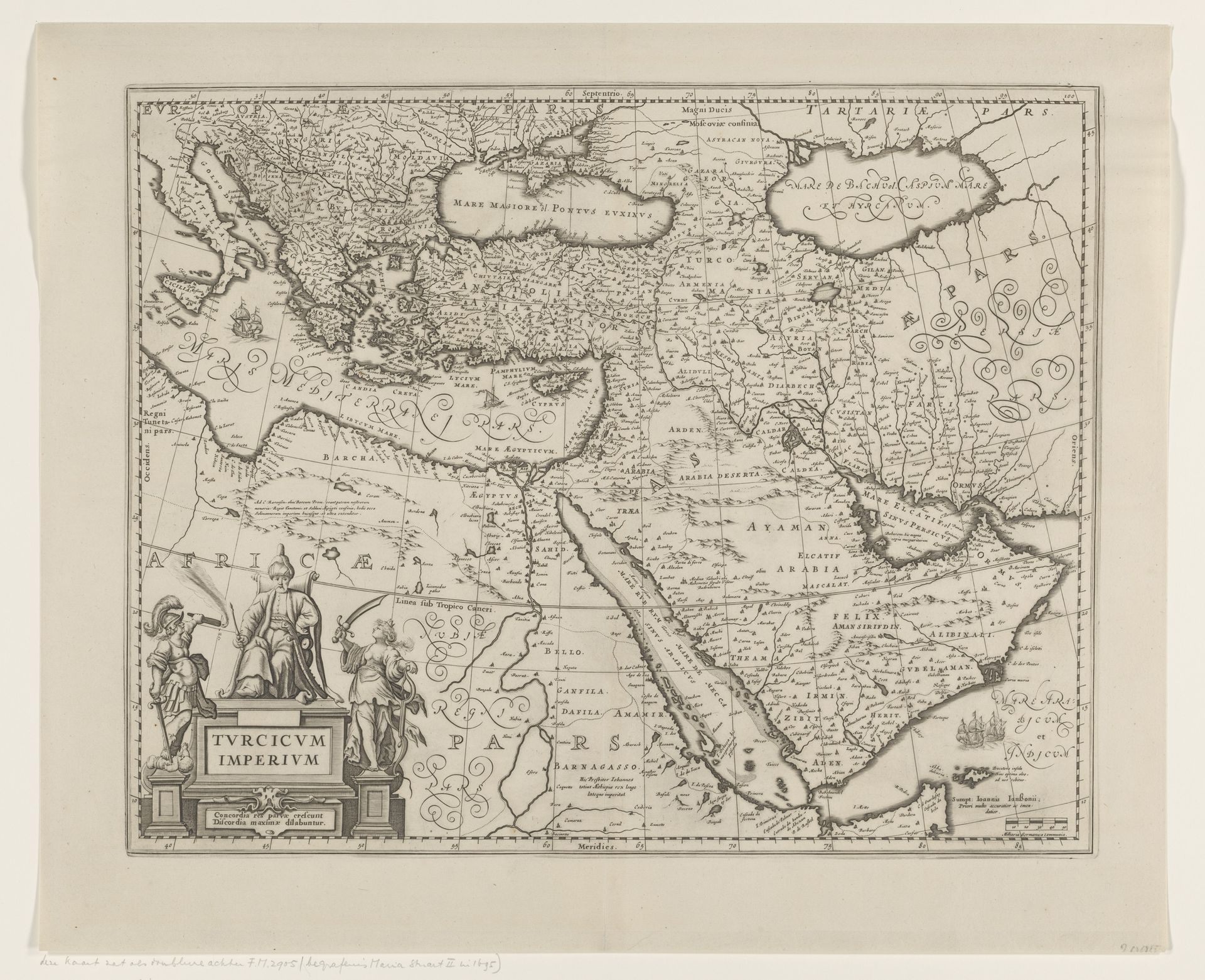
Kaart van het Ottomaanse Rijk
Anonymous
@anonymousLocation
RijksmuseumListen to curator's interpretation
Curatorial notes
This is an anonymous map of the Ottoman Empire, a print that employs line and form to define geographical and political space. The formal elements of the map, such as the intricate lines delineating borders, rivers, and coastlines, construct a visual framework that organizes territory. Note how the density of detail varies across regions, possibly reflecting the differing levels of knowledge. The map gives us insight into how cartography was not just about geographic representation but also about constructing a symbolic order. The map frames how the Empire wanted to be seen, and how its regions were understood. In this representational strategy, geographic space is depicted as a structured, knowable entity. As you consider this map, think about how its formal choices reflect and shape our understanding of power and space. Its lines create a sense of order, but also reveal the complexities of trying to define and control territory.