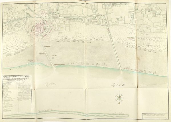
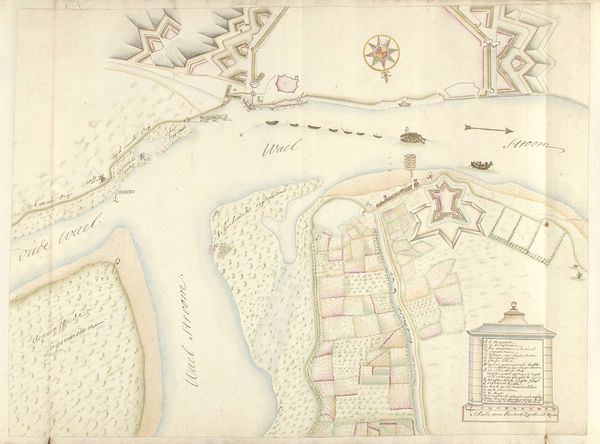
Plattegrond van het in 1654 geplande kanaal tussen Fort Mardijk en Duinkerke 1701 - 1715
0:00
0:00
drawing, print, paper, ink, architecture
#
drawing
#
baroque
# print
#
paper
#
ink
#
cityscape
#
architecture
Dimensions: height 530 mm, width 760 mm
Copyright: Rijks Museum: Open Domain
This is Samuel Du Ry de Champdoré's "Plattegrond van het in 1654 geplande kanaal tussen Fort Mardijk en Duinkerke," a map created in 1654. It pictures a proposed canal between Fort Mardijk and Duinkerke. Du Ry de Champdoré, born into a family of architects and engineers, lived in a time of extensive military conflict and the expansion of empires. The map underscores how geography and infrastructure are fundamental to territorial control. This canal wasn't just about trade; it was a strategic project, reflecting the period's intense power struggles. Consider the labor required to construct such a canal. Who were the people who would have been involved in this project? The map doesn't show them. But it is suggestive of the power dynamics of the era, raising questions about the human cost of these grand designs. Ultimately, this map is not just a depiction of a place, but a document that embodies the political ambitions, social structures, and human experiences of 17th-century Europe.
Comments
No comments
Be the first to comment and join the conversation on the ultimate creative platform.
More like this