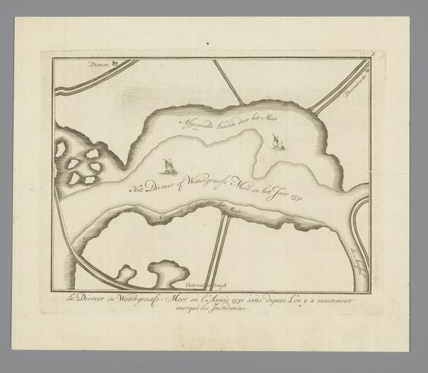
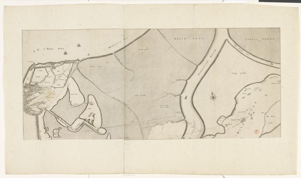
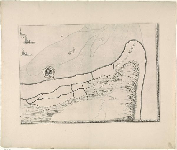
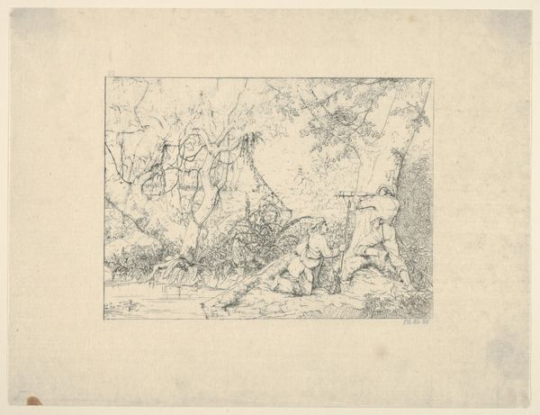
Kaart van het gebied tussen Den Bosch en Geertruidenberg met dijkdoorbraken (zesde blad) before 1757
0:00
0:00
drawing, print, engraving
#
drawing
# print
#
pen sketch
#
old engraving style
#
landscape
#
line
#
history-painting
#
engraving
Dimensions: height 301 mm, width 460 mm
Copyright: Rijks Museum: Open Domain
Curator: Immediately I am struck by a sense of calm precision. The lines, while simple, clearly depict a region with a detailed understanding. There is almost an ethereal stillness in its monochromatic rendering. Editor: This is a pen and ink drawing, possibly an engraving, created sometime before 1757 by an anonymous artist, titled "Kaart van het gebied tussen Den Bosch en Geertruidenberg met dijkdoorbraken (zesde blad)," meaning “Map of the area between Den Bosch and Geertruidenberg with dike breaches (sixth sheet)." It presents a specific geographic location, but hints at much larger social events that changed the land itself. Curator: A map then! Look how bodies of water snake and claim dominance, and how little sailing ships populate its deltas. Given the time, would these dikes have symbolic significance? Was overcoming this geography seen as strength? Editor: Precisely! Dikes, breaches, the controlled and uncontrolled. We must look at the struggle with water here as deeply sociopolitical. Control over water literally meant control over life, agriculture, trade… the power to determine who thrives and who suffers when the inevitable flooding comes. I’d argue the map is therefore not a neutral document but one intrinsically connected to the ruling power’s narratives. Curator: That tension is clearly depicted; human markers attempting to establish boundaries, juxtaposed with waterways moving beyond constraint. Perhaps the map attempts to imbue those structures with enduring symbolic authority, despite their proven fragility. There are cities that serve as visual metonyms of human ingenuity, points of organization upon the chaos. Editor: Yes, each mark conveys not just spatial data, but values of dominance and security. Viewing these landscapes outside their technological and economic implications means missing half the story. Each little boat and town becomes a marker for trade routes, defense strategies and the power relations between people. Curator: Thank you, that really allows us to consider both its design and function. Editor: And hopefully to see the hand of the powerful even where its direct expression is absent. It makes you question what a map does, or even is *for.*
Comments
No comments
Be the first to comment and join the conversation on the ultimate creative platform.
More like this