drawing, graphic-art, print, etching, ink, engraving
#
drawing
#
graphic-art
#
comic strip sketch
# print
#
pen illustration
#
pen sketch
#
etching
#
asian-art
#
personal sketchbook
#
ink
#
ink drawing experimentation
#
pen-ink sketch
#
pen work
#
sketchbook drawing
#
storyboard and sketchbook work
#
sketchbook art
#
engraving
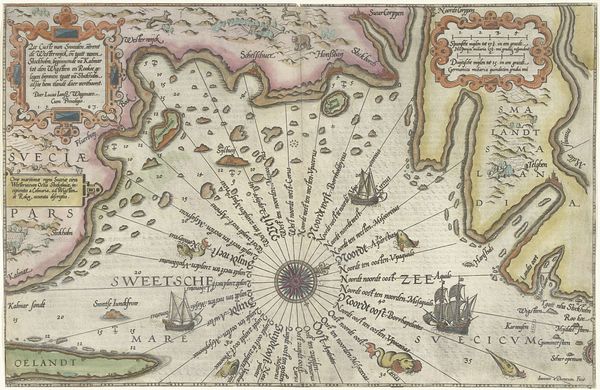
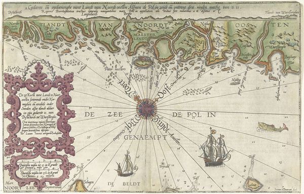
Dimensions: height 160 mm, width 208 mm
Copyright: Rijks Museum: Open Domain
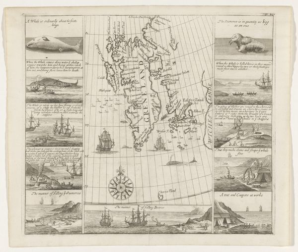
This map of the coast near Xiamen was made in 1632 by an anonymous artist. The image presents us with the problem of understanding the politics of imagery and the social conditions that shape artistic production. The map, which depicts the region around the port city of Xiamen, offers a bird's-eye view of the coastal geography and sea routes. The inclusion of sailing ships highlights the importance of maritime trade and naval power. Made during a period of increasing European presence in East Asia, this map most likely served a strategic function, assisting Dutch or other European traders and military planners in navigating the complex coastal waters. It’s an example of how cartography, particularly in a colonial context, can be considered a form of power, used to survey, claim, and control territories. To fully understand this map, we need to dig into the archives of the Dutch East India Company and other historical sources, to reveal the complex social and political context in which it was produced and used.
Comments
No comments
Be the first to comment and join the conversation on the ultimate creative platform.
More like this