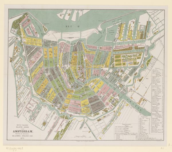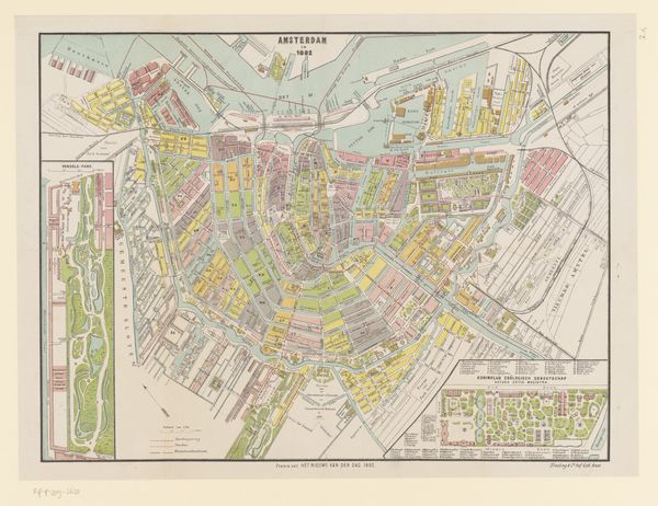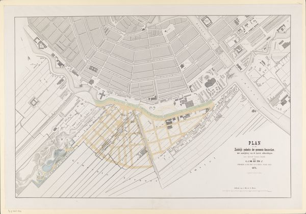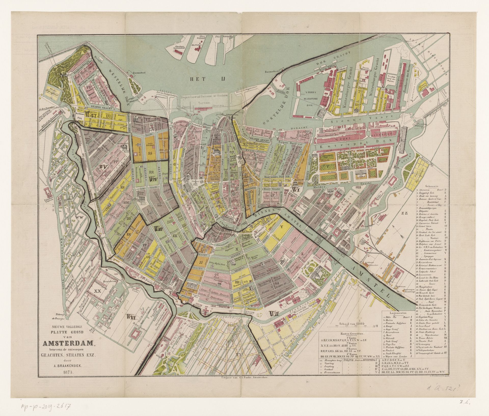
1873
Plattegrond van Amsterdam
Listen to curator's interpretation
Curatorial notes
Curator: Looking at this rendering of Amsterdam, I immediately sense order—a carefully planned configuration laid bare before us. Editor: Yes, it is strikingly well-organized! This "Plattegrond van Amsterdam" from 1873, crafted by Albertus Braakensiek, uses drawing and print techniques to capture the city's detailed layout. It's remarkable to observe urban development frozen in a moment. Curator: What I find truly compelling is what the piece reveals about 19th-century societal values. Note how Amsterdam is depicted not merely as a place but as a complex network. The map serves less as navigational tool, and more as an artifact, reflecting an epoch marked by colonialism, trade and power dynamics all intricately woven into the cityscape. Editor: Absolutely, the presentation betrays social undercurrents within what it represents. The varying districts of color almost visualize economic stratifications, implying segregated zones. Even though the drawing doesn’t directly present explicit inequalities, their essence underlies what’s omitted—a certain critical discourse absent from this sanitized depiction. Curator: Consider also how the inclusion of infrastructure elements—canals, specifically—foregrounds Dutch achievements in engineering and water management. This depiction implicitly reinforces prevailing ideas about the nation’s relationship with the surrounding terrain. The absence of working-class areas or spaces of informal settlements creates a deliberate visual narrative. Editor: Right. The composition isn’t neutral. Despite its objective pretense, every map projects intent; and the intent behind 'Plattegrond' could reinforce notions about imperialist expansion, resource extraction, and capitalist commerce systems by carefully crafting Amsterdam. Curator: Such a reading reminds me of postcolonial critiques against representation! It suggests these cartographic exercises serve hegemonic objectives even when unintentionally conveying them in what initially appear as impartial artifacts that unintentionally transmit concealed historical structures rooted across complex landscapes over the ages. Editor: Examining such artworks closely prompts profound questioning around dominant discourses permeating visual legacies which challenge existing understandings as such, creating grounds where dialogue confronts power itself, eventually sparking thoughtful engagement involving identity formation throughout society's course. Curator: Reflecting on it now, seeing Braakensiek’s creation offers insight—the piece opens avenues to understand urban identity coupled to forces underpinning modern societies formation altogether—Amsterdam's evolving narrative still resonates worldwide centuries hereafter... Editor: I leave now feeling even sharper in perception by recognizing intricate forces that both shape lived space/consciousness throughout history that this map has triggered within everyone too--forever reframing dialogues forward hereafter!