print, etching
#
dutch-golden-age
# print
#
etching
#
landscape
#
etching
#
geometric
#
islamic-art
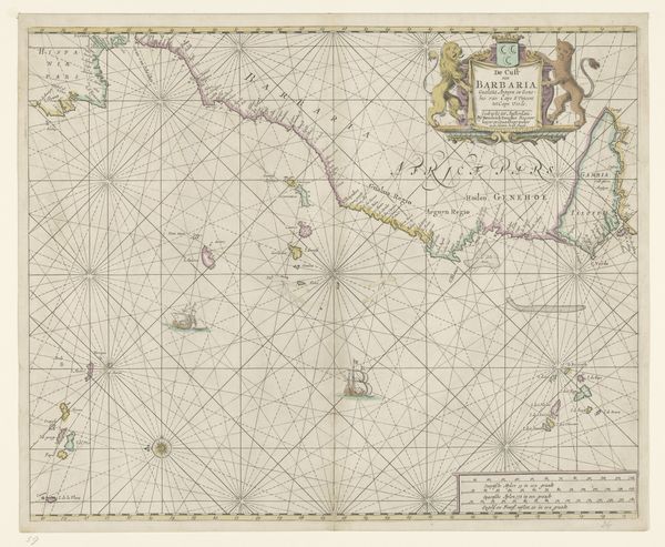
Dimensions: height 445 mm, width 550 mm
Copyright: Rijks Museum: Open Domain
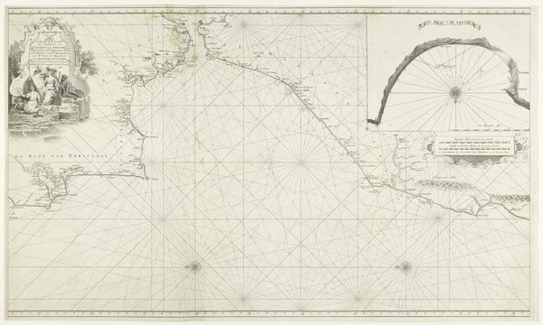
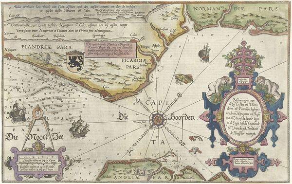
Hendrick Doncker created this map of the African Gold Coast in Amsterdam, and it reflects the complex social and economic currents of the 17th century. This navigational chart, crisscrossed with lines to aid sea travel, visualizes more than just geography. Look at how the image creates meaning. It presents the West African coast as a resource ripe for Dutch trade. The figures above the title, representing the region’s inhabitants, are rendered as exotic and available, framing Africa as a land of opportunity for European exploitation. Produced during the height of the Dutch Golden Age, this map exemplifies the close relationship between cartography and commerce. The Dutch East and West India Companies relied on such maps to navigate and control trade routes, solidifying their economic and political power. Resources such as archives, company records, and travel logs, help us unpack the intertwined histories of trade, colonialism, and representation.
Comments
No comments
Be the first to comment and join the conversation on the ultimate creative platform.
More like this