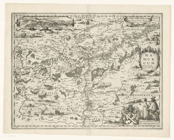
1617 - 1622
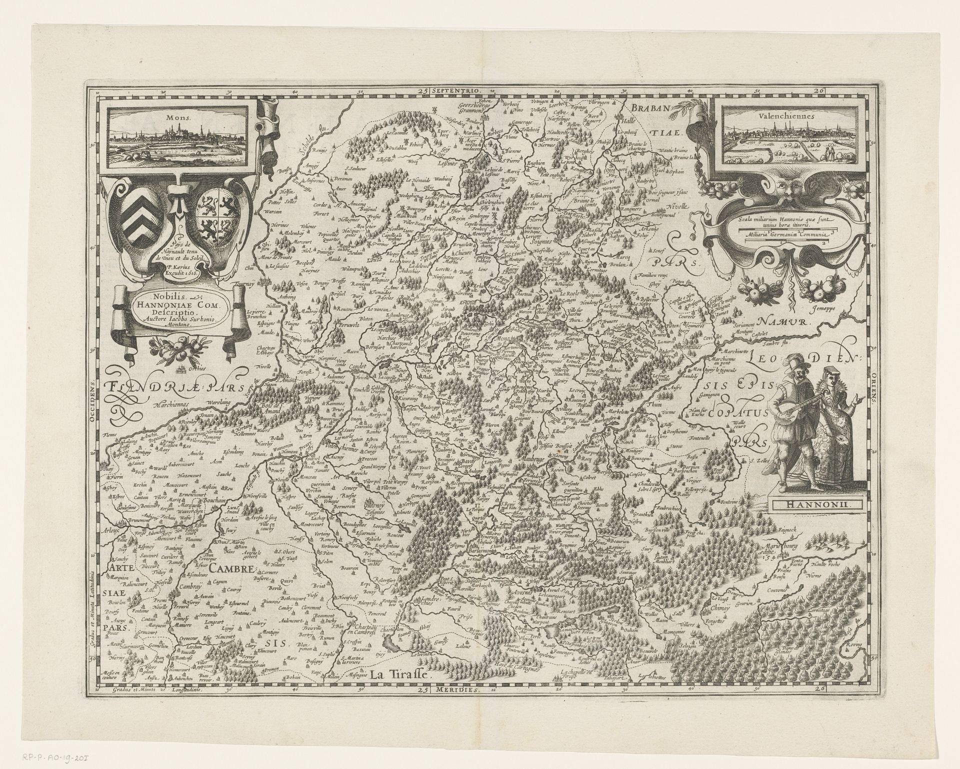
Kaart van het graafschap Henegouwen, met een gezicht op Bergen en Valenciennes
Listen to curator's interpretation
Curatorial notes
Curator: This engraving, dating from 1617 to 1622, presents a "Kaart van het graafschap Henegouwen, met een gezicht op Bergen en Valenciennes"—a map of the County of Hainaut, with views of Mons and Valenciennes. Editor: It's striking how detailed and almost ornate the landscape is. The forests are so dense, like miniature tapestries. There's something powerful about representing a whole region in this way. It evokes both possession and a yearning for that place. Curator: Indeed. What we see here reflects the concerns of the early modern period: defining territories and asserting dominion. These maps weren't simply geographical tools, but assertions of political authority. Consider the elaborate cartouches and heraldic symbols; they speak to the social order. Editor: Absolutely. The use of heraldry ties the land to specific families and noble lines. The cities pictured become symbols of power. These aren’t just visualizations; they're arguments about belonging and control. The anonymous artist carefully constructs a narrative of land ownership, visually dictating a very specific understanding of the area. Curator: And let's remember the context. The Baroque era was steeped in spectacle, even when dealing with seemingly pragmatic things like mapping. The visual richness, while beautiful, served to legitimize existing power structures. How the land is rendered conveys value, resources, strategic positions. Editor: It prompts us to consider whose perspective is privileged in this depiction. Are the rural populations and laborers, who intimately knew that terrain, represented here, or is their existence eclipsed by symbols of power and property? These images are far from neutral; they reflect, and also construct, historical realities. Curator: Exactly. These images are loaded documents, worthy of continuous questioning and historical contextualization. What can these types of maps teach us about today's society? Editor: I see maps as potent reminders of how power and identity intersect, and that artistic output is inextricably linked to its social milieu. A map shows territory, but more so it shows intent. Curator: Thank you for sharing these thoughtful reflections, highlighting this work's multilayered appeal.