print, etching, paper, engraving
#
aged paper
# print
#
etching
#
old engraving style
#
landscape
#
paper
#
orientalism
#
engraving
Dimensions: height 228 mm, width 164 mm
Copyright: Rijks Museum: Open Domain
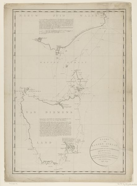
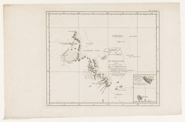
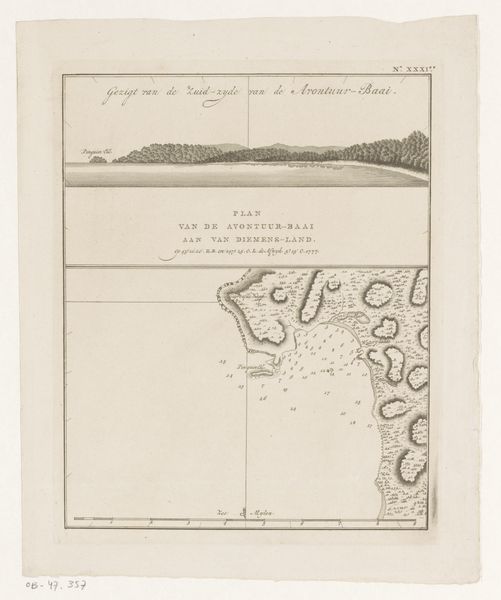
This map of the coast of Tasmania was made anonymously around 1773, likely as a printed illustration. The lines and lettering were etched into a metal plate, probably copper, then inked and pressed onto paper. Consider the labor involved in making this image. The copperplate engraving would’ve demanded a skilled hand, someone who could patiently translate geographic observation into a precise, reproducible image. Mapping has always been tied to power, and this map is no exception. By charting the coast, the Dutch could claim ownership, turning the land into a resource to be exploited. The map's neat, measured lines mask the messy, violent process of colonization. It reduces a complex landscape and its inhabitants to a set of coordinates, a resource to be managed. In that sense, even a seemingly objective map like this one is a powerful assertion of control, made possible by skilled labor and a colonial agenda.
Comments
No comments
Be the first to comment and join the conversation on the ultimate creative platform.
More like this