drawing, print, paper, photography, ink
drawing
asian-art
paper
photography
ink
Dimensions: height 215 mm, width 290 mm
Copyright: Rijks Museum: Open Domain
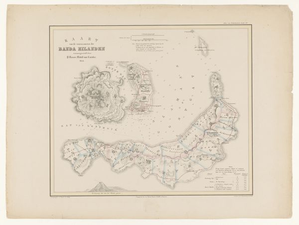
Editor: So, here we have "Geologische kaart van steden bij Padang," a geological map of cities near Padang, created sometime between 1840 and 1880 by O.F.U.J. Huguenin. It looks like a drawing or print, maybe using ink on paper? I find it fascinating how maps blend artistry and scientific information. What draws your attention when you look at this piece? Curator: I see a record of labor and imperial ambition. This wasn't simply a disinterested charting of the land. Consider the production of the materials: the ink, the paper, the tools used for surveying and drafting. Who produced these? Were they sourced locally, or imported, contributing to a network of colonial resource extraction and consumption? And what about the labour involved? It was someone’s work. How was the cartographer compensated, and what was the social context of the people he interacted with while surveying the area? Editor: That's a great point. I hadn’t considered the socio-economic implications of the materials themselves. It speaks to how maps are products of specific economic systems. What do you mean exactly about colonial context? Curator: This map wasn't made in a vacuum. Padang was under Dutch colonial rule during this period. Mapping was crucial for resource control, administration, and military strategy. Each line and symbol represents a potential site for exploitation, investment, or domination. Consider how the selection of information – what to include, what to omit – also shapes perception and reinforces power dynamics. What wasn’t included? Local, vernacular information perhaps? Editor: That reframes the entire piece for me. Instead of just seeing lines on paper, I see a snapshot of colonial power at work. Curator: Exactly! By analyzing the materials and the context of its creation, we reveal a much more complex story about labour, power, and the imposition of a European vision on the Indonesian landscape. We must move away from thinking of things of high art vs utilitarian artifact. These things speak for themselves, especially because labor makes art. Editor: This has definitely given me a fresh perspective on how to look at even seemingly simple maps.
Comments
No comments
Be the first to comment and join the conversation on the ultimate creative platform.