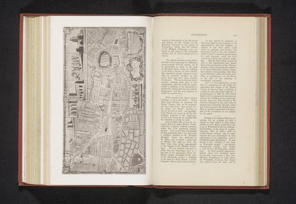
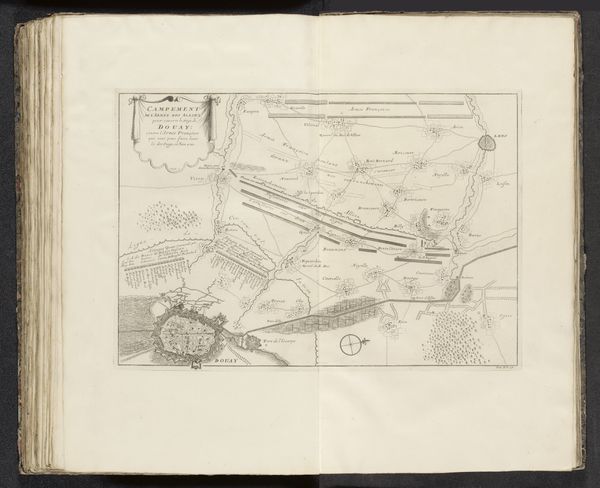
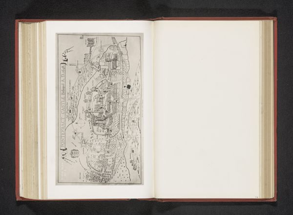
drawing, print, engraving
#
drawing
# print
#
landscape
#
cityscape
#
engraving
Dimensions: height 80 mm, width 191 mm
Copyright: Rijks Museum: Open Domain
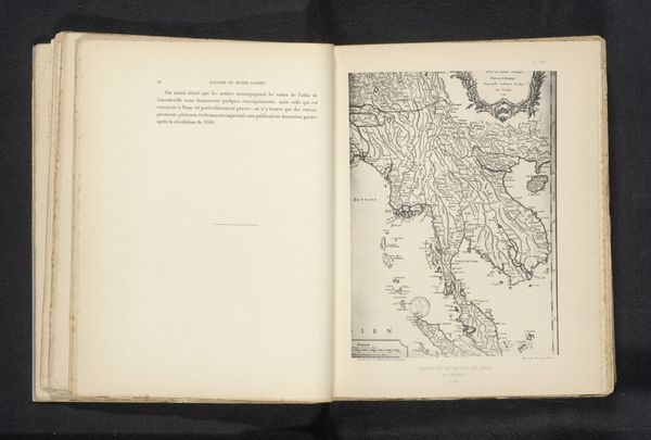
Editor: Here we have a reproduction of a map of Pontefract, created before 1887. It's an engraving, and it’s giving me this detached, almost bird's-eye perspective of the cityscape. What catches your eye in this piece? Curator: It is interesting how the lines define the space. The very architecture is evoked using very stark, thin lines. Note how the engraver uses varying line weights to articulate the differences in the landscape’s surfaces. Look closely; do you observe how textures are being created merely through varied line density? Editor: Yes, I see that. The density definitely creates the darker areas that suggest depth. How does this conscious construction through line contribute to the artwork? Curator: It foregrounds the idea that a city, like any representational form in art, is carefully planned and executed, a network of interlocking components represented here through the formal properties of line and space. The print uses the basic elements of art, such as line and value, to produce a stark image whose formal austerity belies the complexities it signifies. Is it representational of a moment or of a duration? Editor: It makes me think about how maps are both practical tools and artistic renderings, where form follows function but also expresses a specific worldview. Thanks, this close-reading approach is something I'll keep in mind. Curator: It’s a valuable reminder that a critical vocabulary is not necessarily determined by historical data, so it may be employed as the tools with which to better understand all artwork.
Comments
No comments
Be the first to comment and join the conversation on the ultimate creative platform.
More like this