Reproductie van een prent van een belegeringsplan van het Beleg van Pontefract before 1887
0:00
0:00
drawing, print, engraving
#
drawing
# print
#
engraving
Dimensions: height 105 mm, width 181 mm
Copyright: Rijks Museum: Open Domain
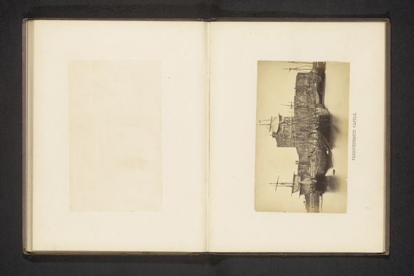
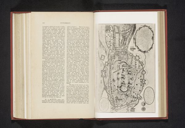
This is an anonymous reproduction of a print depicting the siege of Pontefract Castle in 1648, rendered with ink on paper. Pontefract, in Yorkshire, was a key site of conflict during the English Civil War, enduring multiple sieges due to its strategic importance. This plan offers a bird's-eye view of the castle and its surrounding landscape during a period of intense political and social upheaval. The Civil War era was marked by deep divisions across lines of class, religion, and allegiance, embodying a clash between Royalist and Parliamentarian forces. Maps like this were not merely tools for military strategy; they were also instruments of power, shaping perceptions of territory and control. While seemingly objective, this plan is a subjective interpretation of a contested space, framing Pontefract as a site of domination. Consider how this image portrays the relationship between those laying siege and those within, and ponder on how such conflicts have shaped identities and power structures throughout history.
Comments
No comments
Be the first to comment and join the conversation on the ultimate creative platform.
More like this