drawing, print, ink, engraving
drawing
baroque
perspective
form
ink
geometric
line
cityscape
history-painting
engraving
Dimensions: height 136 mm, width 211 mm
Copyright: Rijks Museum: Open Domain
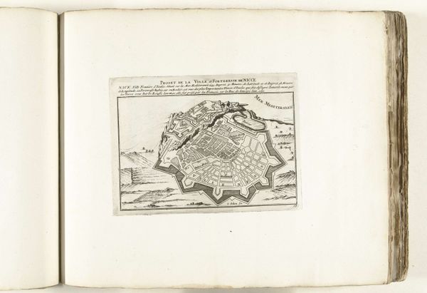
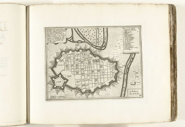
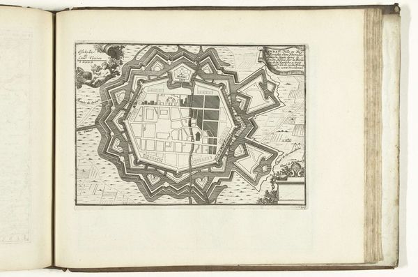
This is an anonymous print from 1693, offering a bird's-eye view of Nice. The image encapsulates the period's fascination with urban planning and military strategy. The map depicts Nice as a fortified city, its walls and bastions projecting power and control. Its presence in the Rijksmuseum collection suggests the Dutch Republic's interest in the Mediterranean region, driven by trade, politics, and military considerations. The inclusion of a female personification adds an allegorical dimension, associating the city with classical virtues or regional identity. To fully understand this print, one would need to research the military history of Nice, the development of cartography, and the role of the Dutch Republic in European geopolitics. Such research would reveal how the image reflects and reinforces social structures and power relations. It serves as a reminder that art is always embedded in specific social and institutional contexts.
Comments
No comments
Be the first to comment and join the conversation on the ultimate creative platform.