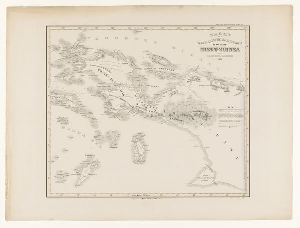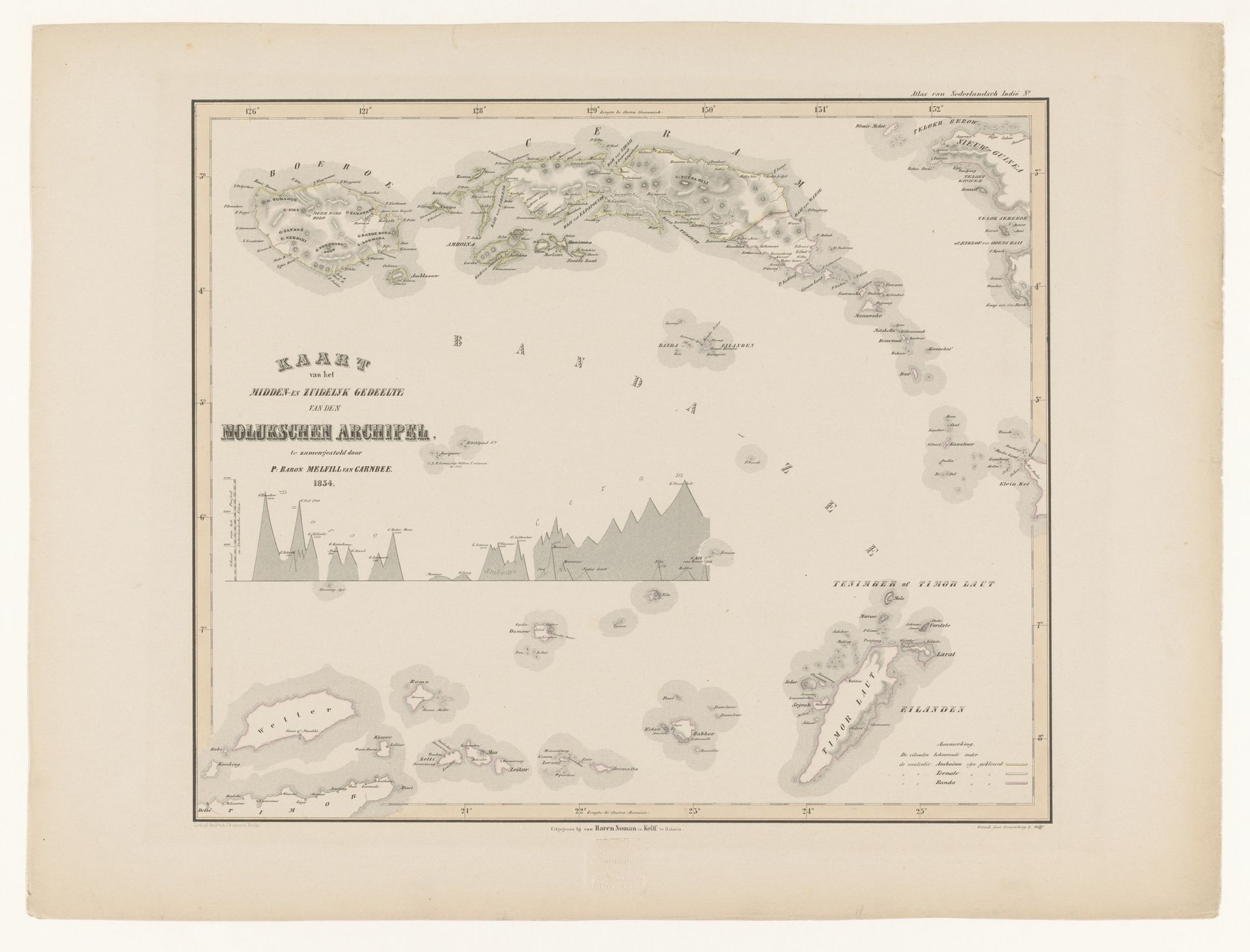
1854
Kaart van de Molukse eilanden Seram en Buru
F. Cronenberg
@fcronenbergLocation
RijksmuseumListen to curator's interpretation
Curatorial notes
Editor: This is F. Cronenberg's 1854 "Kaart van de Molukse eilanden Seram en Buru," an engraving housed at the Rijksmuseum. It’s intricate; it seems both scientific and somehow…ominous, like a blueprint for something. What historical narratives do you see embedded in this map? Curator: What I see is an assertion of colonial power masquerading as scientific objectivity. Maps were never neutral documents; they were tools used to claim, control, and exploit territories. Notice how meticulously the coastlines are rendered, while the interiors remain somewhat vague? Editor: Yes, that’s striking. It's like the Dutch are saying, "We’ve mapped the perimeter; now the rest is ours." Curator: Exactly! Consider, too, what’s being mapped: the Moluccas, the "Spice Islands." These islands were, for centuries, violently fought over for their control of the global spice trade. How does the engraving technique itself – that precise, linear aesthetic – contribute to this idea of control and order? Editor: It gives it an air of authority. The clean lines suggest that this is a definitive, trustworthy representation of the region, erasing any indigenous perspectives or knowledge. It becomes a symbol of imposed Western understanding. Curator: Precisely. It also helps us examine who had the ability, the resources, and the desire to commission something like this. Who was the audience? And what were their intentions for such a representation of territory? Editor: That’s powerful. I initially just saw a historical map, but now I see a complex web of power, exploitation, and erasure embedded in every line. Curator: And hopefully, that understanding helps us to see these types of cultural dynamics in contemporary society today. There's value in that.