print, engraving
#
neoclacissism
# print
#
old engraving style
#
geometric
#
cityscape
#
history-painting
#
engraving
Dimensions: height 387 mm, width 370 mm
Copyright: Rijks Museum: Open Domain
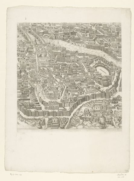
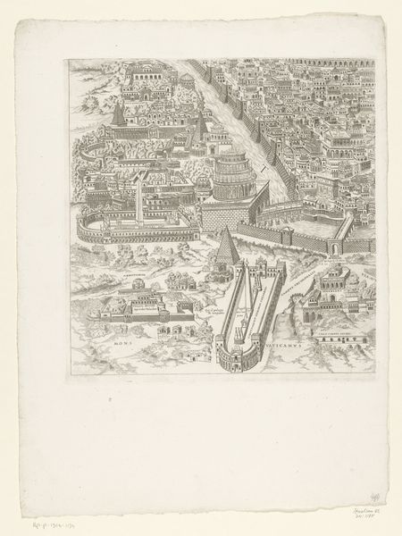
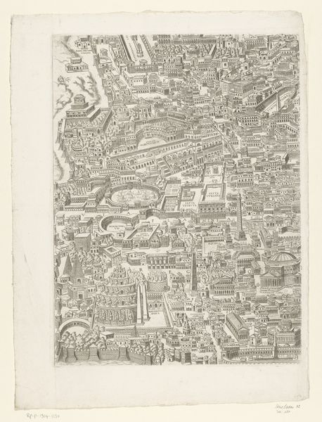
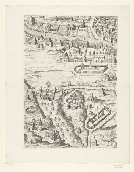
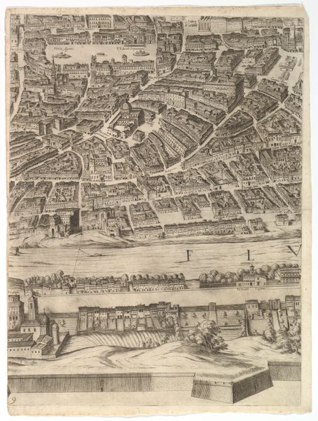
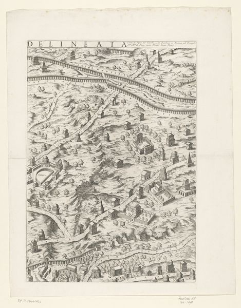
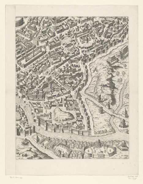
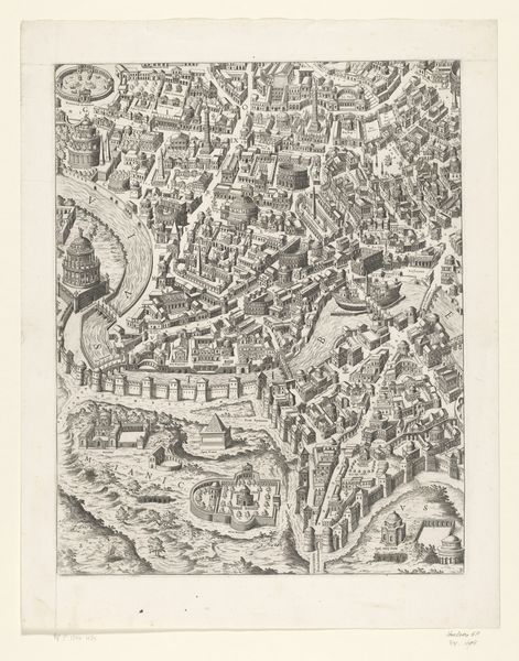
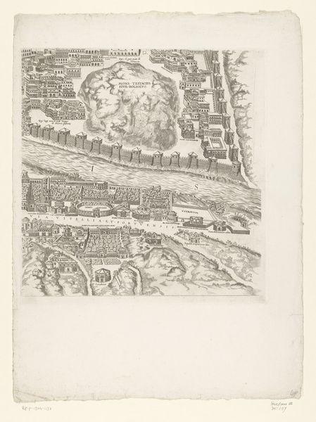
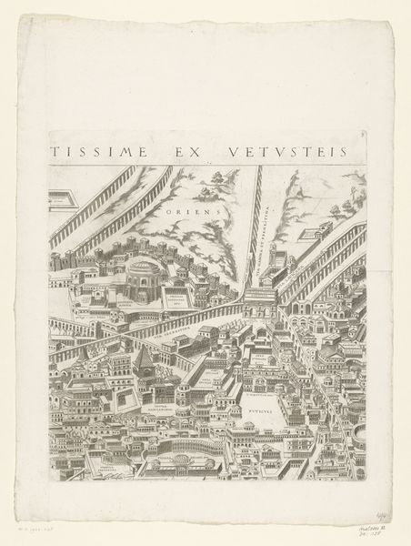
This is the tenth section of an anonymous print showing a notional map of ancient Rome. The image offers an imagined bird's-eye view of the city. The river Tiber runs through the middle, bisecting the space. The high walls and fortifications tell us about the perceived need to protect Rome. What we are looking at isn't just a map; it is a symbolic representation of Roman power. Prints like these circulated widely and played an important role in shaping perceptions of the classical world. They served a didactic purpose and fueled the cultural phenomenon of the Grand Tour, in which elites from across Europe visited the sites of antiquity as a rite of passage. To better understand images such as these, scholars consult a variety of sources including historical maps, civic records, and archaeological surveys. This interdisciplinary approach helps us to understand the place of art within the broader culture that produced it.
Comments
No comments
Be the first to comment and join the conversation on the ultimate creative platform.
More like this