1709
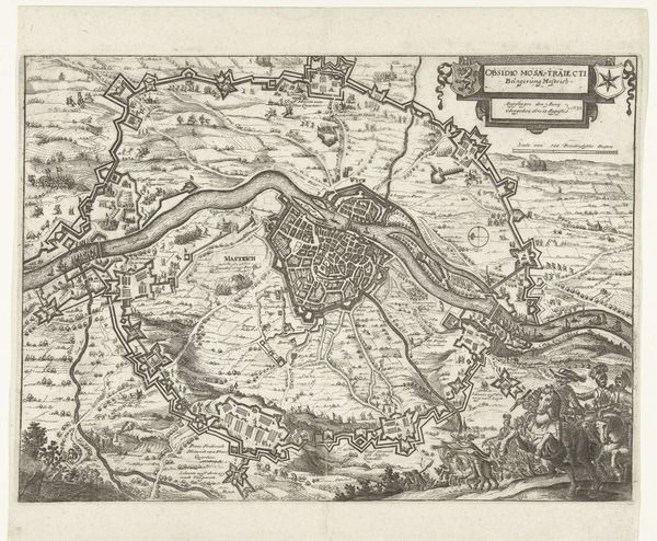
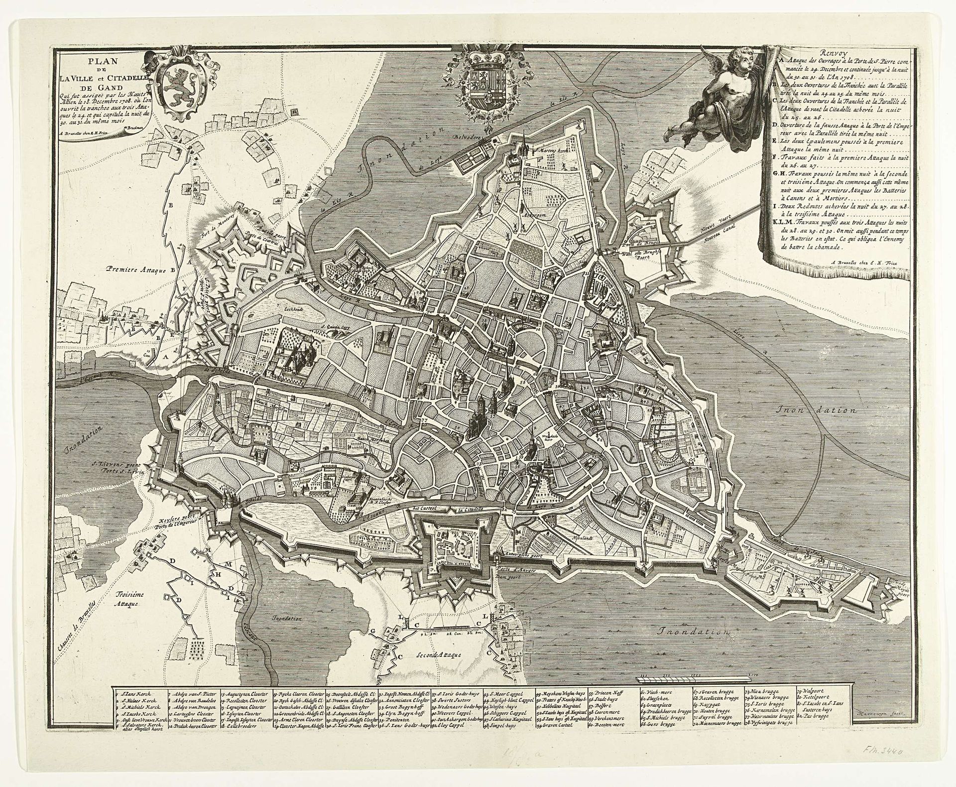
Plattegrond van het beleg van Gent, 1708
Jacobus Harrewijn
1660 - 1732Location
RijksmuseumListen to curator's interpretation
Curatorial notes
Curator: The precision of this map is striking; I feel almost omniscient, gazing down upon the city. It gives off a feeling of controlled power. Editor: Absolutely. And it’s important to remember, we're looking at "Plattegrond van het beleg van Gent, 1708," a drawing dating from 1709. The artist, Jacobus Harrewijn, meticulously documented the siege. What sociopolitical statement do you believe he was trying to make with it? Curator: Power is an important consideration. The map itself can be understood as an assertion of dominance – who gets to depict, to survey, to know. The very act of creating this bird's-eye view elevates the cartographer, and by extension, those who commissioned and would have utilized this. Editor: Maps during this period were powerful tools of both knowledge and political control. This image not only documents a specific historical event – the siege – but it also functions as propaganda, shaping perceptions of power and the vulnerability of the city. Curator: I'm curious about Harrewijn's positioning here. His allegiance is somewhat ambiguous; did he see himself simply as documenting the realities of military conflict? Or did he have more invested in the political implications, or consequences, of this depiction? Where do local populations appear here in this illustration of war? Editor: Well, given the period – the early 18th century – and the artistic conventions, it is likely Harrewijn operated within the framework of his patrons' needs and expectations. And in that sense, it’s fascinating to see how this type of map serves specific functions for those with power, influencing spatial imagination. Curator: So how might we see it beyond military utility? The representation of space and its intersectional impacts...does this suggest the beginnings of the kind of controlled urban spaces we continue to struggle with today? Editor: Certainly. This siege map, for instance, goes beyond merely recording a historical battle, hinting at more complex relations between control, representation, and power. The map serves to both dominate and render a kind of beauty from distance, which is certainly haunting. Curator: Indeed. Seeing this plan now helps highlight the ever-evolving, sometimes brutal relationship between spaces, conflicts, and those that lay claim. Thanks to cartography, we witness our cities change and are left wondering who shapes and dictates its spaces. Editor: Exactly. By exploring these questions and using historical images, we not only connect history with present-day social theories, but are encouraged to reflect on contemporary life itself.