print, engraving
baroque
pen sketch
old engraving style
perspective
geometric
cityscape
engraving
Dimensions: height 700 mm, width 940 mm
Copyright: Rijks Museum: Open Domain
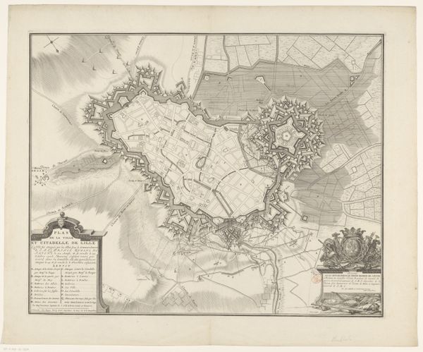
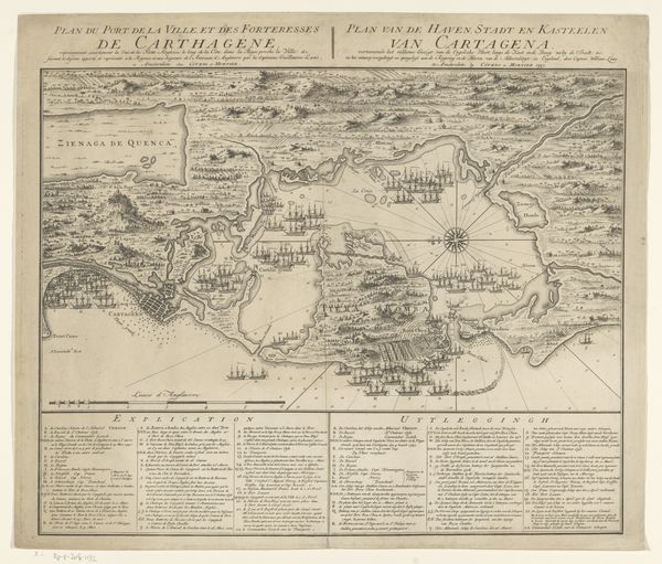
This is an anonymous 1716 map of Temesvár, now Timișoara, a Romanian city with a rich cultural heritage. The map was made during a pivotal moment in the city’s history, just before it was captured by Prince Eugene of Savoy from the Ottoman Empire. Looking at this meticulous depiction, consider how maps like this were more than geographical tools; they were instruments of power. They not only charted territory, but laid claim to it, embodying the political and military ambitions of empires. Temesvár, throughout its history, has been a melting pot of ethnicities and religions. This detailed plan offers a silent testimony to the diverse communities that once lived within its walls. It also captures a moment of transition. After the Habsburg conquest, Temesvár underwent significant changes, and this map allows us to reflect on the city's layered identities. It serves as a reminder of the ever-shifting borders and cultural landscapes that shape our world.
Comments
No comments
Be the first to comment and join the conversation on the ultimate creative platform.