About this artwork
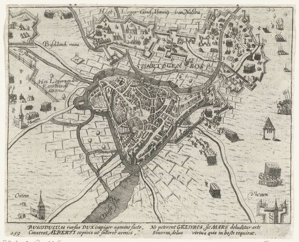
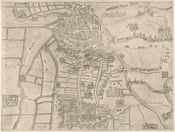
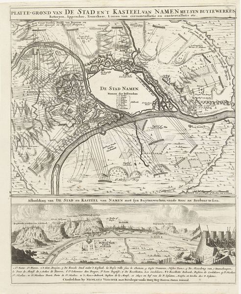
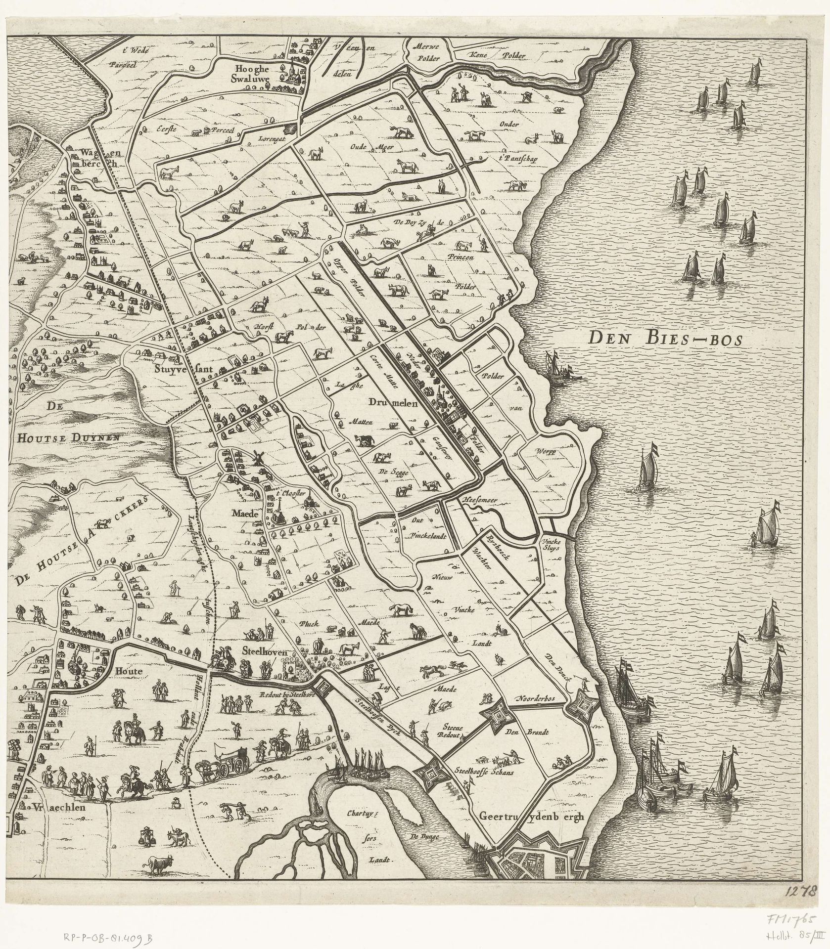
Editor: So this engraving, "The Siege of Breda," made by Pieter Hendricksz. Schut in 1637, really lays out the land with striking clarity. I'm curious about the visual choices and what they might signify beyond just topography. What stands out to you? Curator: Maps are so much more than just representations of space, aren't they? Look at how Schut meticulously delineates not only fortifications but also the agricultural plots and the strategic waterways. Doesn’t it evoke a sense of control, almost a claim to dominion over this contested landscape? The Bies-Bosch sea dotted with ships really speaks to Dutch power and trade. Editor: I hadn’t thought about it that way, but you're right; the detail does create a feeling of mastery. So how do those meticulously depicted plots and ships become symbols themselves? Curator: Exactly! Each element carries a weight. The regimented fields become emblems of productivity and prosperity, fundamental to the Dutch Golden Age. The ships, icons of mercantile ambition and naval strength, ready to facilitate cultural and economic exchange. Schut seems to celebrate their achievements during times of war, can't you feel it? Editor: I can. Now that I'm looking closer, it feels like the image almost transforms the event into a symbolic representation of Dutch identity. I will consider Dutch paintings, maps and prints with so much more intention! Curator: It’s all about understanding the layers of visual language. When a place or even people are drawn in such a style they acquire power, memory, and influence across centuries. A good place to further our research!
Beleg van Breda (rechter blad), 1637 1637
Pieter Hendricksz. Schut
1619 - 1660Location
RijksmuseumArtwork details
- Medium
- print, engraving
- Dimensions
- height 369 mm, width 349 mm
- Location
- Rijksmuseum
- Copyright
- Rijks Museum: Open Domain
Tags
baroque
dutch-golden-age
landscape
geometric
cityscape
engraving
Comments
No comments
About this artwork
Editor: So this engraving, "The Siege of Breda," made by Pieter Hendricksz. Schut in 1637, really lays out the land with striking clarity. I'm curious about the visual choices and what they might signify beyond just topography. What stands out to you? Curator: Maps are so much more than just representations of space, aren't they? Look at how Schut meticulously delineates not only fortifications but also the agricultural plots and the strategic waterways. Doesn’t it evoke a sense of control, almost a claim to dominion over this contested landscape? The Bies-Bosch sea dotted with ships really speaks to Dutch power and trade. Editor: I hadn’t thought about it that way, but you're right; the detail does create a feeling of mastery. So how do those meticulously depicted plots and ships become symbols themselves? Curator: Exactly! Each element carries a weight. The regimented fields become emblems of productivity and prosperity, fundamental to the Dutch Golden Age. The ships, icons of mercantile ambition and naval strength, ready to facilitate cultural and economic exchange. Schut seems to celebrate their achievements during times of war, can't you feel it? Editor: I can. Now that I'm looking closer, it feels like the image almost transforms the event into a symbolic representation of Dutch identity. I will consider Dutch paintings, maps and prints with so much more intention! Curator: It’s all about understanding the layers of visual language. When a place or even people are drawn in such a style they acquire power, memory, and influence across centuries. A good place to further our research!
Comments
No comments