drawing, print, paper, ink
#
drawing
# print
#
asian-art
#
landscape
#
paper
#
ink
Dimensions: height 395 mm, width 214 mm
Copyright: Rijks Museum: Open Domain
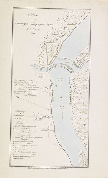
This is an anonymous map of the river near Palembang, made in 1821. It’s a detailed sketch, rendered in delicate lines, presenting a bird's-eye view of a river and its surrounding topography. The formal arrangement is striking, dividing the composition into distinct zones. Notice the cartographic style. It is a blend of precision and abstraction, where the actual landscape gives way to a symbolic representation. The river acts as a spine, around which other elements cluster: settlements, geographical markers, and annotations. Each mark and line seems carefully placed, contributing to a broader system of signs. The map presents not just a geographical space but also a structured narrative about territory, power, and knowledge. Consider how this map challenges our perception of space. It presents a flattened, ordered view of a complex reality. This piece invites us to consider how maps shape our understanding of the world, not just as neutral documents but as constructed representations of space and power.
Comments
No comments
Be the first to comment and join the conversation on the ultimate creative platform.
More like this