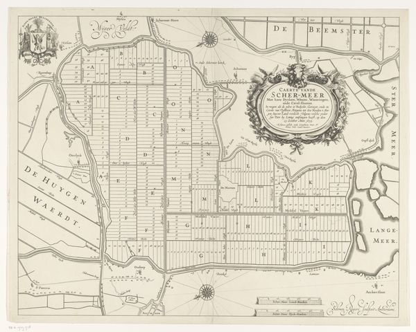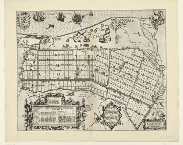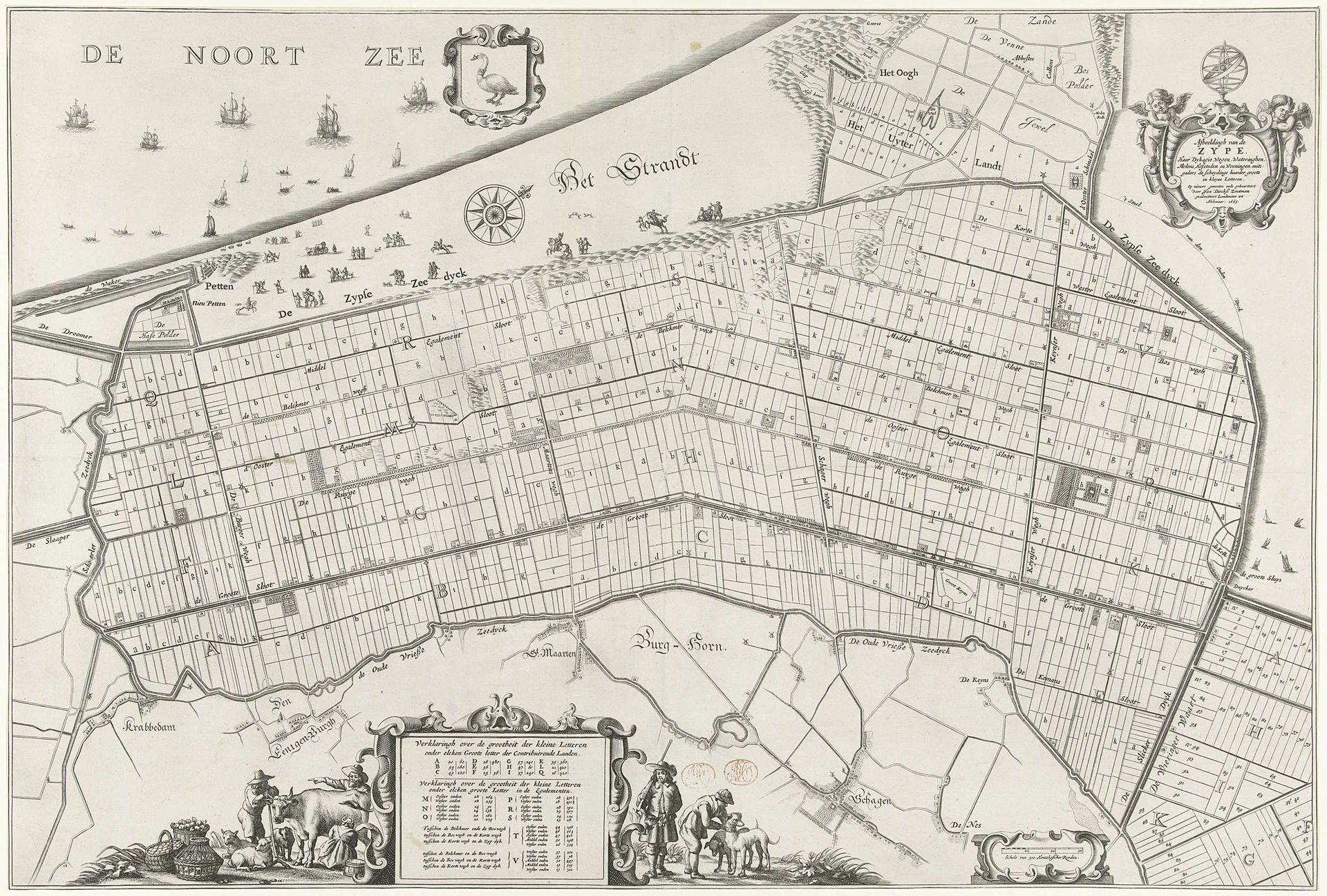
after 1665
Kaart van de Zijpe- en Hazepolder
Reinier van Persijn
1614 - 1668Location
RijksmuseumListen to curator's interpretation
Curatorial notes
Editor: So, this is "Kaart van de Zijpe- en Hazepolder," a map created after 1665 by Reinier van Persijn. It's a drawing and print, mostly in ink and engraving. What immediately strikes me is how ordered it appears – almost like a geometric puzzle. How do you interpret this work? Curator: The "order" you observe hints at a deeper symbolic narrative. Maps in this period were not merely geographical tools, but assertions of control and understanding over a landscape increasingly shaped by human intervention. Consider the very act of mapping: it's a way of naming, classifying, and ultimately possessing space. What does the Zijpe- and Hazepolder, now clearly divided into grids, represent in the collective memory of the Dutch Golden Age? Editor: I suppose it represents land reclamation, the struggle against the sea, and the creation of fertile farmland. The rigid grid emphasizes control. Curator: Precisely! And within this visual language, the images that populate the map become significant. The crests, figures, and even the ships on the sea – each tells a story of power, trade, and civic identity. Are there any particular symbols or images that catch your eye? Editor: I notice the decorative cartouches with figures, which seem to add a sense of grandeur to an otherwise functional document. And also the coat of arms, the wind rose... Curator: Exactly. And what cultural echoes do you perceive in the inclusion of those elements? Can you imagine what these may have symbolized? Editor: They definitely add a layer of officialdom and maybe prosperity? It makes me realize this map served purposes beyond just navigation, maybe as a display of Dutch ingenuity. Curator: Precisely. It is a visualization of their cultural aspirations, their engineering prowess, and their burgeoning global power. It serves as a potent reminder that maps can reveal as much about a society's values and ambitions as they do about its geography. Editor: It's fascinating how a simple map can be decoded to reveal so much about a society's ambitions and values.