print, paper, engraving
#
baroque
#
dutch-golden-age
# print
#
paper
#
geometric
#
cityscape
#
history-painting
#
engraving
Dimensions: height 502 mm, width 583 mm
Copyright: Rijks Museum: Open Domain
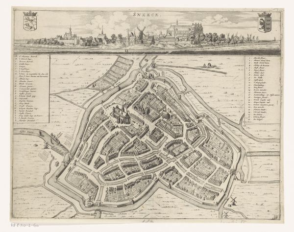
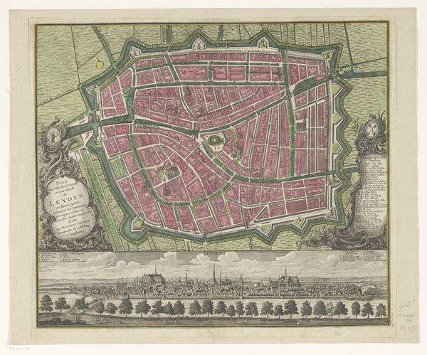
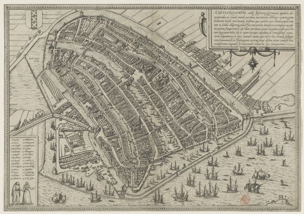
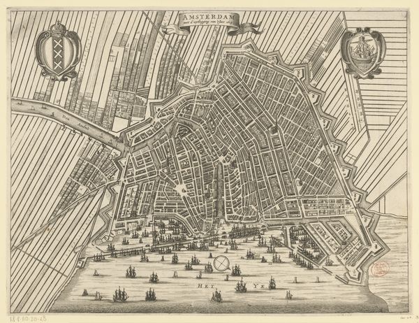
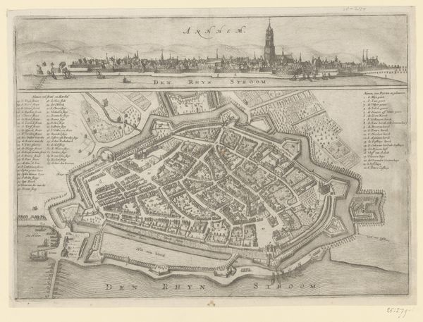
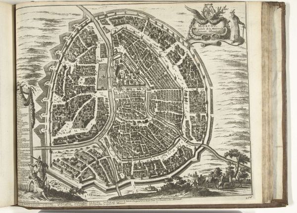
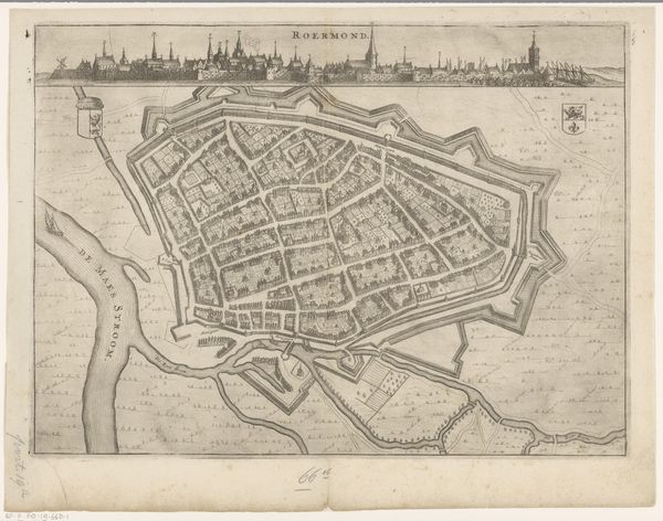
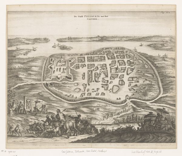
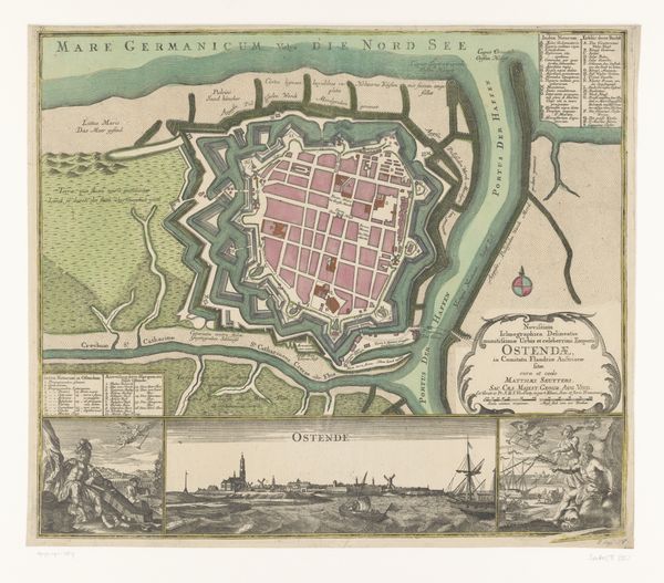
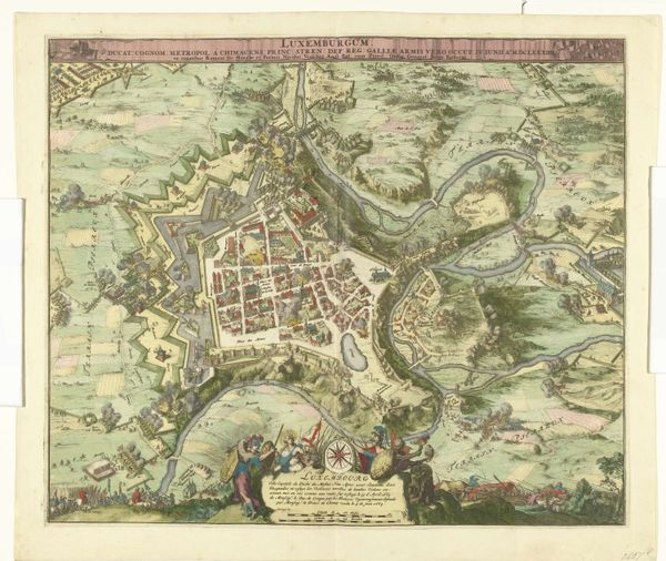
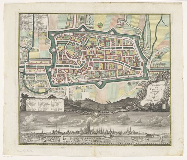
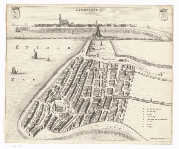
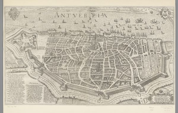
Curator: Matthaeus Seutter’s 1728 engraving, "Plattegrond van Harlingen," meticulously depicts the Dutch city's layout, offering a glimpse into 18th-century urban planning. Editor: Immediately, the geometry strikes me. It's almost diagrammatic, reducing lived space to pure, rational form, though the maritime details give it a sense of location. Curator: Indeed. Observe how the fortified city is rendered almost as a self-contained unit, geometrically precise, enclosed within its walls and waterways. Note the calculated lines. Editor: Yes, the rigid structure certainly highlights the controlled power dynamic between rulers and residents within this maritime hub, part of a strategic network in the Dutch Golden Age. How do these planned spaces affect individual lived experiences, particularly concerning issues of class or trade? Curator: Let’s return to the formal composition, noting the use of line and negative space, typical of Baroque printmaking traditions. There's a hierarchical arrangement in how Seutter positions elements – the city plan dominating the upper register, with a prospect view of the harbor below, and flanking cartouches, each contributing to the overall structural unity. Editor: Though I understand your emphasis, doesn't focusing solely on the aesthetic composition detract from crucial societal aspects represented within the cartography, aspects related to power, colonialism, and trade that fundamentally shaped life within Harlingen and influenced wider networks of commerce during this time? Curator: Well, the very act of creating and disseminating such prints reinforced existing hierarchies. And the work functions beautifully as a symbol of civic pride and progress. The details such as coats of arms give added cultural meaning. Editor: Quite right; while you’re pointing at details that capture an intended air of progress, there’s also that implied act of surveying, classifying and controlling land use inherent in the construction of such images and others from that era. Curator: Reflecting on the image then, my appreciation lies in how it manages to transform tangible geographical information into abstract aesthetic form, and how effectively it communicates values of spatial awareness in that process. Editor: And I see it as a tool, subtly conveying the influence of civic and colonial structures, highlighting how cartography during this period played a significant role in influencing control over populations, places, and resources.
Comments
No comments
Be the first to comment and join the conversation on the ultimate creative platform.
More like this