drawing, print, ink, engraving
#
drawing
#
baroque
# print
#
pen sketch
#
landscape
#
ink
#
cityscape
#
engraving
Dimensions: height 202 mm, width 269 mm
Copyright: Rijks Museum: Open Domain
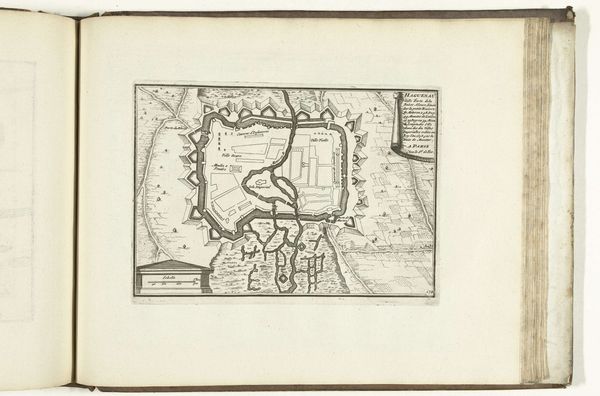
This is a 1726 map of Frankfurt am Main, etched with precision, revealing more than just geographical data. Notice the city's fortifications. These star-shaped walls echo in the designs of Renaissance fortresses, like those of Palmanova, Italy. These aren't just defensive structures; they're powerful symbols of protection and order, a visual language speaking to the era's anxieties and aspirations. The compass rose in the lower left guides our orientation, but it's also a nod to humanity's eternal quest for direction. This symbol goes back centuries. We find its relatives on ancient maps charting unknown territories, each with its unique blend of science and mythology. Maps like these are more than guides; they are artifacts charged with collective dreams, fears, and the relentless, cyclical pursuit of understanding our place in the world.
Comments
No comments
Be the first to comment and join the conversation on the ultimate creative platform.
More like this