About this artwork
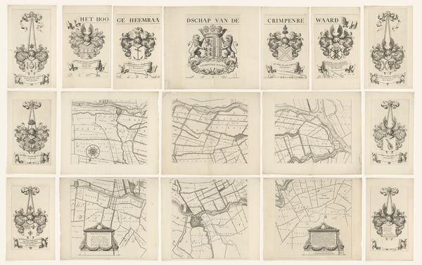
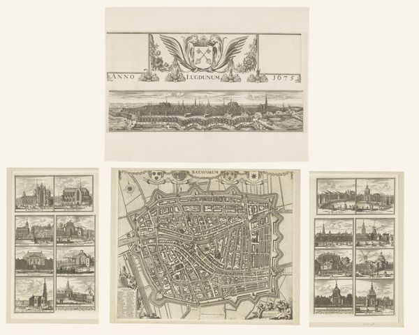
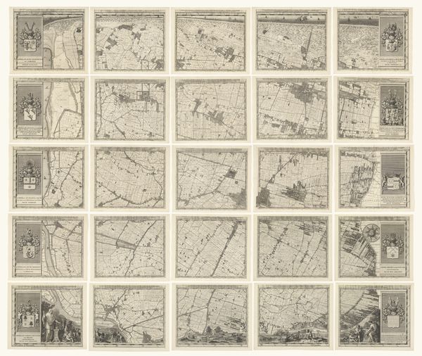
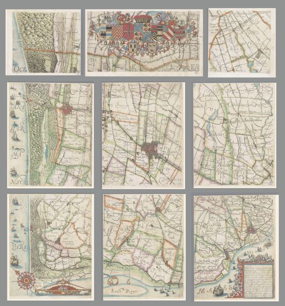
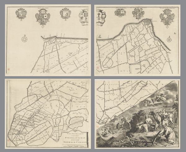
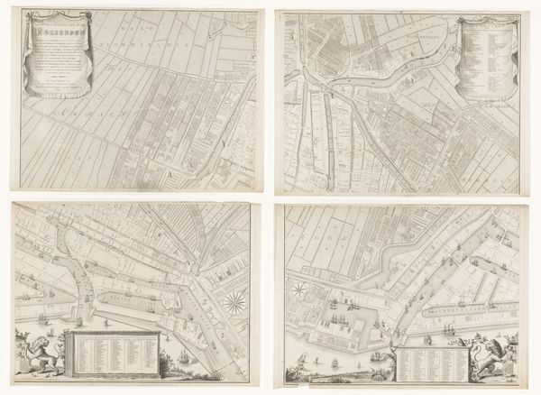
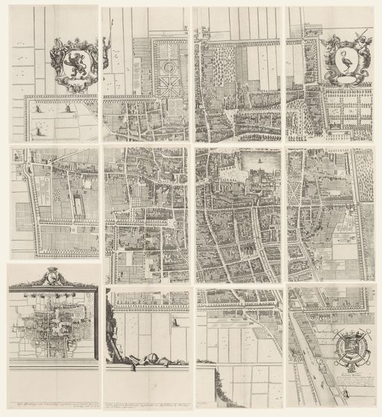
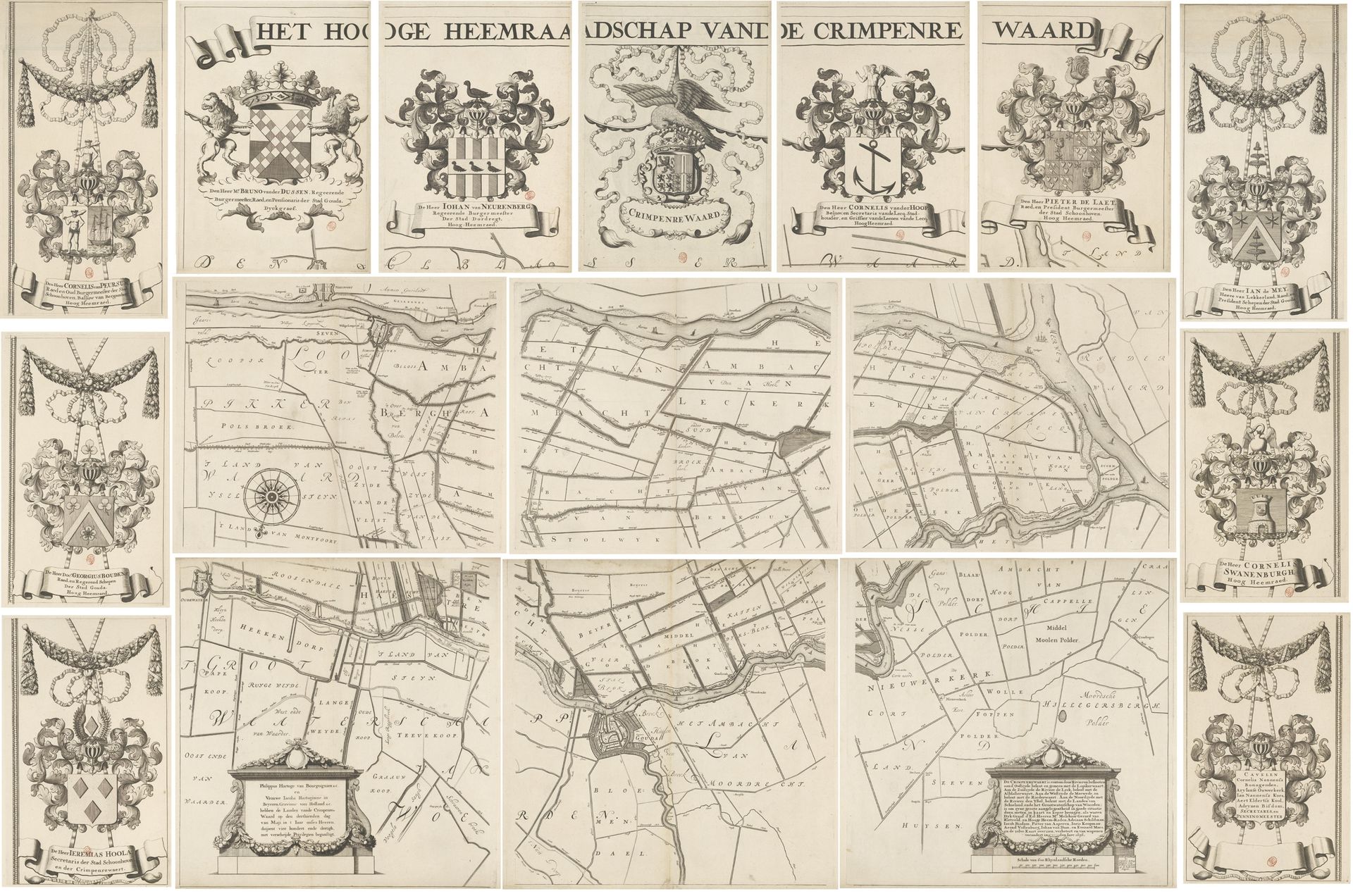
This is Johannes Leupenius's map of the Krimpenerwaard, made around 1675 with pen and gray and brown ink. The map offers a fascinating insight into the administrative and social landscape of the Dutch Republic during its Golden Age. The map is divided into seventeen parts, each detailing a section of the Krimpenerwaard region. The inclusion of coats of arms connects local governance with noble lineage. The intricate network of waterways, plots of land, and polders illustrates the relationship between people and the land in the Netherlands. The elaborate cartouche and compass rose reflect the contemporary Dutch interest in cartography as a science. By studying archival documents, legal records, and family histories, we can understand how the map reflects social hierarchies, land ownership, and the exercise of authority in this period.
Kaart van het Hoogheemraadschap van de Krimpenerwaard, bestaande uit zeventien delen
1683 - 1706
Johannes Leupenius
1643 - 1693Location
RijksmuseumArtwork details
- Medium
- graphic-art, print, engraving
- Dimensions
- height 1408 mm, width 2074 mm
- Location
- Rijksmuseum
- Copyright
- Rijks Museum: Open Domain
Tags
Comments
Share your thoughts
About this artwork
This is Johannes Leupenius's map of the Krimpenerwaard, made around 1675 with pen and gray and brown ink. The map offers a fascinating insight into the administrative and social landscape of the Dutch Republic during its Golden Age. The map is divided into seventeen parts, each detailing a section of the Krimpenerwaard region. The inclusion of coats of arms connects local governance with noble lineage. The intricate network of waterways, plots of land, and polders illustrates the relationship between people and the land in the Netherlands. The elaborate cartouche and compass rose reflect the contemporary Dutch interest in cartography as a science. By studying archival documents, legal records, and family histories, we can understand how the map reflects social hierarchies, land ownership, and the exercise of authority in this period.
Comments
Share your thoughts