graphic-art, print, engraving
#
graphic-art
#
dutch-golden-age
# print
#
cityscape
#
engraving
Dimensions: height 178 mm, width 218 mm
Copyright: Rijks Museum: Open Domain
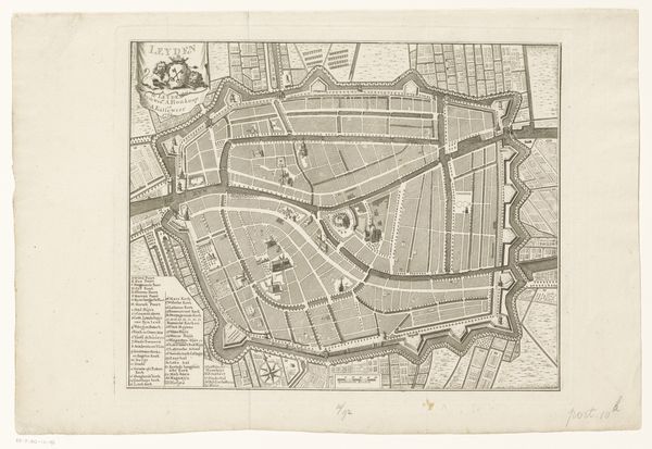
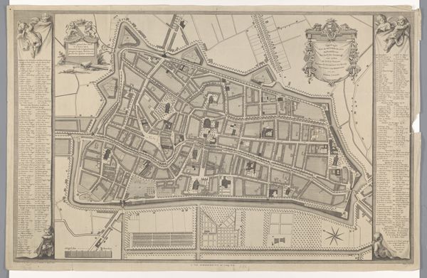
Editor: This detailed print, "Plattegrond van Leiden," or "Map of Leiden," dates from after 1742 and comes to us anonymously from the Dutch Golden Age. It’s an engraving, showcasing the city's layout. The precision is remarkable. What captures your eye, and how do you interpret this intricate cityscape? Curator: Well, first, I imagine someone perched high, gazing down, though, of course, it's all constructed, imagined, from pieces. Notice how the lines aren't just lines; they're narratives. Each street a whisper, each building a stanza in the poem of Leiden. Think about what it meant to map a city then – power, control, but also a sense of belonging. Do you feel that sense of order, perhaps even a kind of beauty in the geometry? Editor: I do, but it also feels a little… sterile? Everything’s so meticulously planned. Curator: Exactly! And isn't that fascinating? The Dutch were masters of order, of managing water, trade, their very lives, almost. Look at the canals acting as veins. Consider, this map is not just about geography. It shows Leiden's economy, society, all etched in ink. Now, how does knowing this change your perspective on its initial "sterility"? Editor: I see it now. It's less sterile and more… intentional. Almost like a portrait of a living thing, but instead of flesh and blood, it’s canals and buildings defining its life force. Curator: Beautifully put. It invites us to be mapmakers ourselves. We add our own experiences to this picture of the city. It really shows that sometimes, even a simple map can open a whole world!
Comments
No comments
Be the first to comment and join the conversation on the ultimate creative platform.
More like this