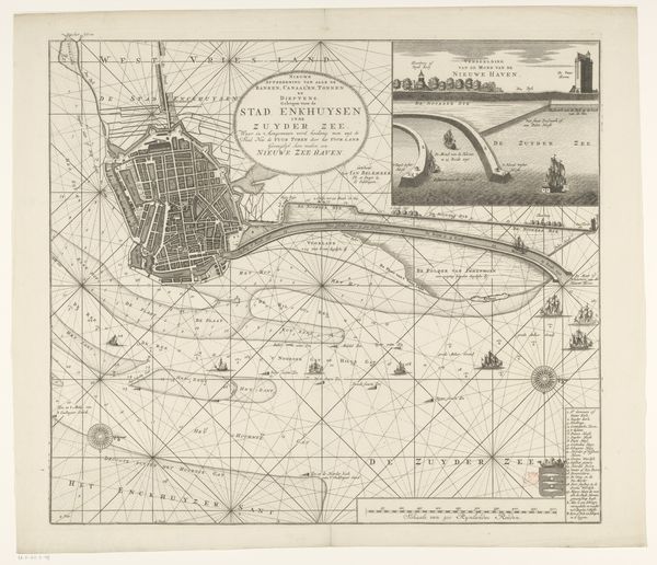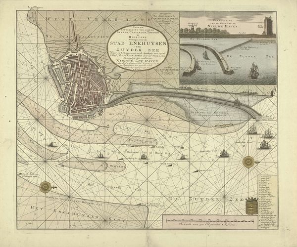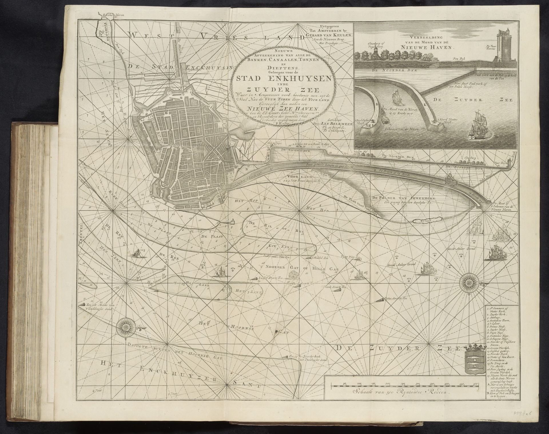
1720
Kaart van het water voor Enkhuizen met de geprojecteerde nieuwe haven, 1720
Listen to curator's interpretation
Curatorial notes
This is an anonymous map of the waterways around Enkhuizen, made in 1720, showing a proposed new harbour. It speaks volumes about the cultural and economic ambitions of the Dutch Republic during its Golden Age. Maps were not just geographical tools; they were potent symbols of power and control. This map showcases the Dutch mastery of hydraulic engineering, crucial for trade and defense. The proposed harbour expansion reflects the city's aspirations for continued economic growth and naval dominance in the Zuiderzee, now known as the IJsselmeer. The detailed depiction of sea routes, compass roses, and the city's infrastructure highlight the importance of cartography in facilitating trade and projecting Dutch influence across the seas. The map’s projection of a future harbour is a commentary on the social structure of its time because it shows the importance of the waterways and the power of the people to change the landscape. Researchers can consult archival records, engineering plans, and maritime histories to gain deeper insights into the social and institutional contexts that shaped this map and the ambitions it represents.