drawing, paper, ink
#
drawing
#
baroque
#
pen sketch
#
paper
#
ink
#
cityscape
Dimensions: height 243 mm, width 298 mm
Copyright: Rijks Museum: Open Domain
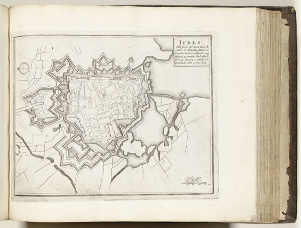
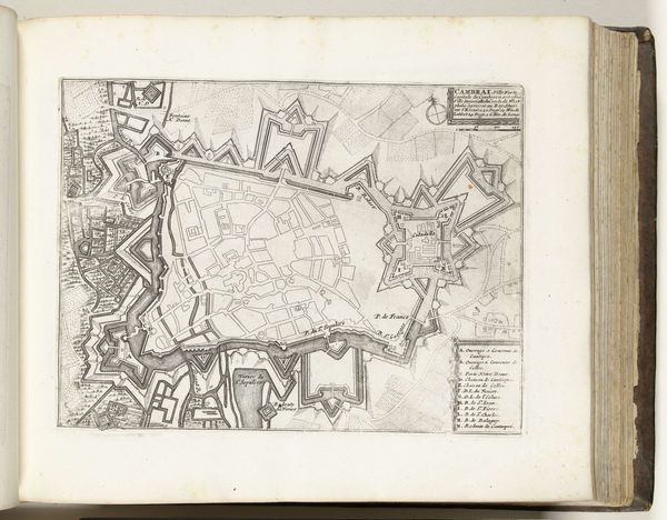
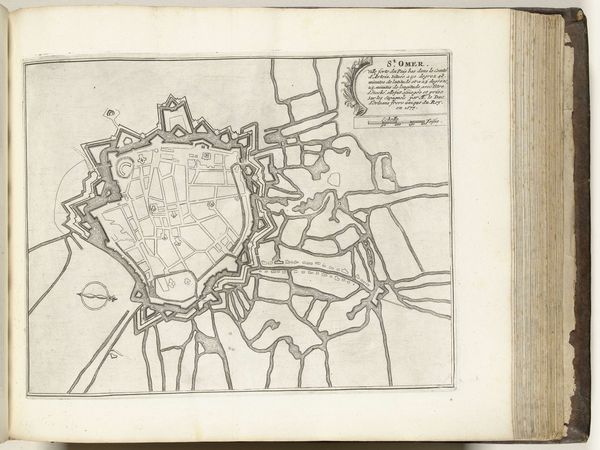
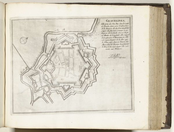
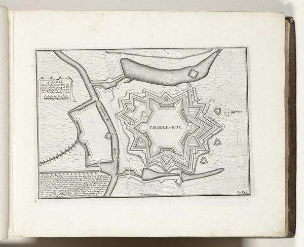
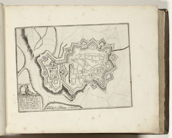
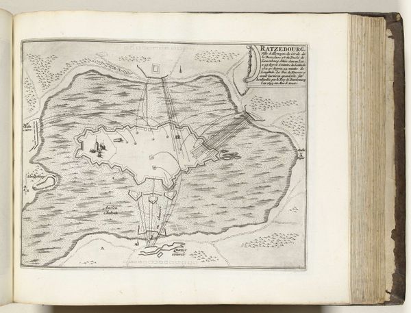
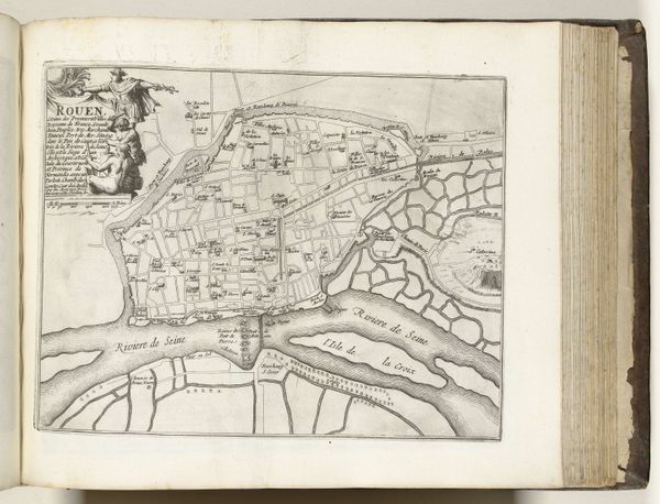
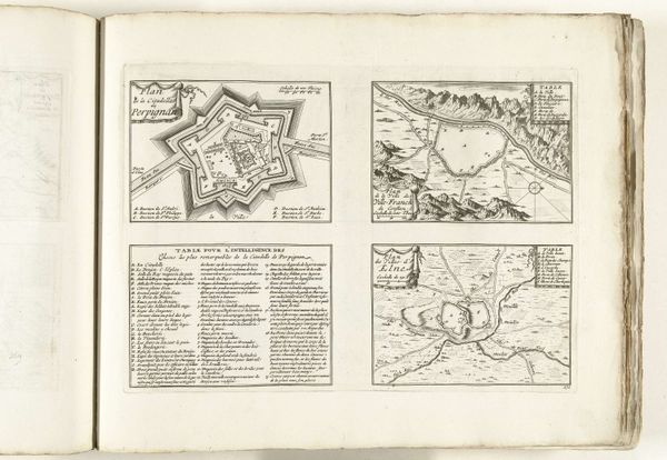
Curator: Welcome. Before us, we have an anonymous drawing titled "Plattegrond van Perpignan," dating from around 1693 to 1696. Editor: My first impression is the meticulous detail—you can almost feel the slow, repetitive labor involved in mapping out this city. It's incredibly precise. Curator: Indeed. These city plans, created using ink on paper, served important functions in the shaping of civic identity. Often commissioned or produced by the governing authorities of cities. Editor: Absolutely. And consider the ink itself, the handmade paper... all the materiality screams craft, labor, and specific forms of social organization, even the star fortress is indicative of warfare. Curator: You raise an interesting point. The fortifications are rendered with exceptional clarity and accuracy which highlights the strategic importance during this period, serving also the propagandistic power the map held, reinforcing the authority and knowledge of whoever ordered the work. Editor: Knowledge IS power. Someone was interested in communicating that control. We see this insistence on delineating space translated from military to mercantile enterprises; we understand it as being very embedded in production and commodification. Curator: The scale feels significant, too. These plans would've been disseminated, seen by a wide range of people and reinforced civic and even national pride. These were instruments of governance. Editor: So, beyond the cartography as simply representative, what did the availability and potential dissemination of this plattegrond mean? How might ordinary people, who had lived, struggled, or had other transactions inside the perimeters represented here, have encountered such images? Curator: Those are key questions when we seek to contextualize these items within the historical landscape. It certainly complicates the reception. Editor: Precisely, thinking of maps less as neutral reflections of space and more as active tools shaped by labor. We can consider its many forms – social, industrial, or the sheer labour in carrying it out. Curator: The confluence of historical context and materiality you are referring to is essential. The intersection tells us so much about not only its creation but also its impact. Editor: It certainly allows a renewed sense of the drawing. We are so used to easy reproduction today. We miss the labor.
Comments
No comments
Be the first to comment and join the conversation on the ultimate creative platform.
More like this