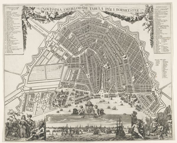
print, engraving
#
dutch-golden-age
# print
#
geometric
#
line
#
cityscape
#
engraving
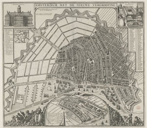
Dimensions: 456 mm (height) x 559 mm (width) (bladmaal)
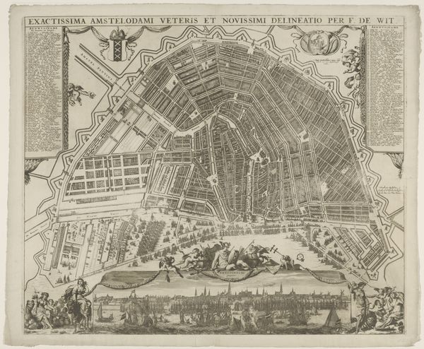
Editor: So, this engraving from 1662, titled "Ground Plan of Amsterdam," by Dancker Danckerts, offers an overhead view of the city. The sheer density of buildings and waterways is striking; you really get a sense of the bustling activity. How do we unpack the layers of history and societal forces at play in this piece? Curator: Indeed, what we are seeing here is not simply a map, but a carefully constructed image, pregnant with socio-political meaning. The Dutch Golden Age was, after all, a period of intense economic and territorial expansion. How might this influence the way Amsterdam is represented here? Editor: Hmm, so the precision in depicting streets and canals—does that signal a kind of civic pride or perhaps a need to assert control? Curator: Exactly! Consider the intended audience and the power dynamics at play. Maps like these served multiple purposes. On the one hand, to display Amsterdam’s modernity, prosperity and maritime prowess through a carefully managed depiction of space. And who does the management of space benefit in a growing urban center? Editor: I see what you mean. It’s a promotional tool and a record, but also maybe a tool of governance, shaping how people understood and interacted with the city? It even dictates how future planning and growth were conceptualized! Curator: Precisely! And this kind of planned growth served as a kind of brand recognition on the global scene. The city presented an image that projected stability and authority. Editor: That's a lot to think about; it changes how I view something that seems as simple as a map. Thanks! Curator: It goes to show you how much even seemingly simple depictions of reality can hide complex motives. My pleasure!
Comments
No comments
Be the first to comment and join the conversation on the ultimate creative platform.
More like this