drawing, ink
#
drawing
#
aged paper
#
light pencil work
#
neoclassicism
#
hand drawn type
#
landscape
#
personal sketchbook
#
ink
#
journal
#
fading type
#
sketchbook drawing
#
watercolour illustration
#
sketchbook art
#
watercolor
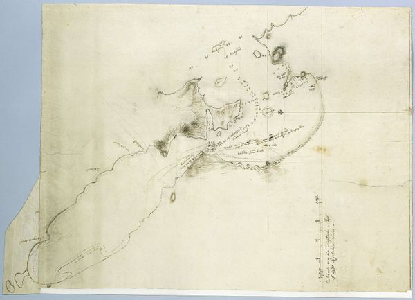
Dimensions: height 890 mm, width 630 mm
Copyright: Rijks Museum: Open Domain
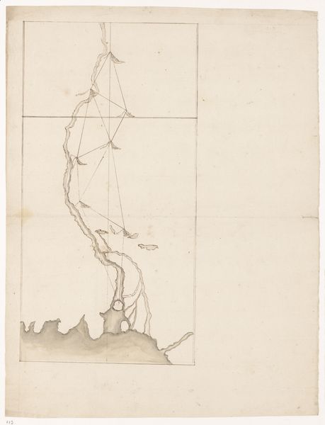
Robert Jacob Gordon created this "Kaart van Saldanhabaai, met een deel van de kust" or "Map of Saldanha Bay, with part of the coast" as a pen and ink drawing. The light washes of grey articulate the concavity of the bay. The lines, though delicate, trace the edges of coastlines and demarcate areas of land and sea, creating a legible representation of space. The map presents a structured, almost scientific rendering of Saldanha Bay. Yet, as we examine this cartographic piece through a structuralist lens, the map is more than just objective data. It is encoded with colonial intentions, presenting a spatial logic that enabled navigational and territorial claims. The meticulous lines and annotations become signifiers, symbols of power and control, which are embedded within the map's formal structure. Notice how the scale and orientation impose a specific worldview. The creation of this map and others like it solidified European dominance, recasting landscapes into resources ripe for extraction and control.
Comments
No comments
Be the first to comment and join the conversation on the ultimate creative platform.
More like this