print, ink, engraving
# print
#
pen illustration
#
pen sketch
#
old engraving style
#
landscape
#
ink
#
geometric
#
engraving
Dimensions: height 379 mm, width 515 mm
Copyright: Rijks Museum: Open Domain
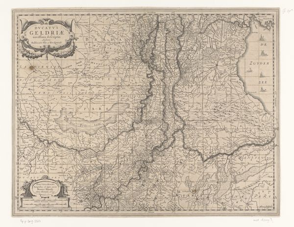
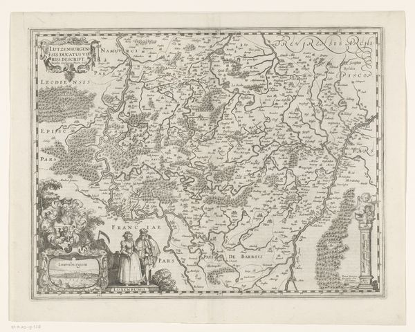
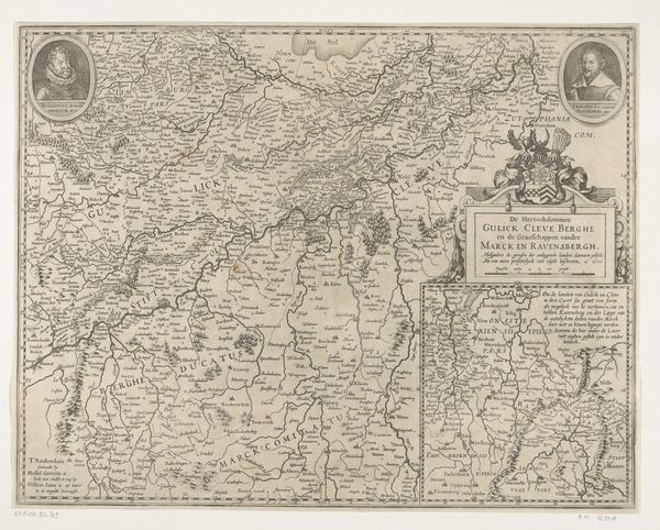
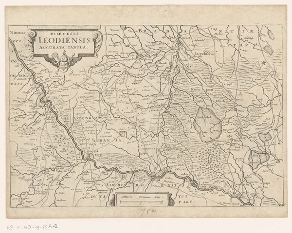
Curator: What immediately strikes me is the incredibly detailed linework; it feels almost obsessive. There’s a delicacy here, rendered with ink on paper. Editor: Indeed. This is a map, "Kaart van het graafschap Zutphen," from 1675. Its artist is anonymous. What makes it so compelling is less about a singular artistic genius and more about the social context. It's part of a larger visual project meant to display and administer a particular territory. These maps were vital to power structures and economic control in the 17th century. Curator: Of course, I'm intrigued by the symbols. Beyond just geographical locations, you see coats of arms and decorative cartouches – it speaks to both status and the desired symbolic narrative the map intends to convey about this land. Are there specific images here that carry weight? Editor: Absolutely. Notice the prominence of particular cities and rivers. This map isn't a neutral depiction; it's shaping how viewers understand the region. We can study this map as propaganda or simply a method of imposing structure and order in the territory through graphical elements. The way borders are drawn and emphasized—it all plays into defining and solidifying power. Curator: Right, that is interesting. Borders as potent symbols... lines can delineate far more than just land, after all. And that decorative title cartouche with its flourish, nearly masks a declaration about rightful rule and territory ownership, doesn't it? It’s almost an attempt to assert visual dominance through ornamentation. Editor: Precisely! And considering the technologies of reproduction at the time like the etching/engraving, such widespread printing and distribution further underscores how this map participated in broad historical narratives and had tangible, public impacts in shaping the perceptions of power. Curator: So while seemingly pragmatic in its design and use, maps can also reveal grand aspirations, as if geography and art merge into a projection of power? It has much to say, even silently. Editor: Yes, visual creations are always caught up in a larger world of social history. These objects served instrumental and persuasive roles. Hopefully, this piece enhances awareness of maps and other visualizations we often take for granted today!
Comments
No comments
Be the first to comment and join the conversation on the ultimate creative platform.
More like this