drawing, print, ink, engraving
#
drawing
#
baroque
# print
#
landscape
#
perspective
#
ink
#
cityscape
#
engraving
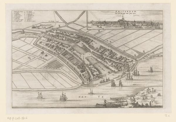
Dimensions: height 265 mm, width 342 mm
Copyright: Rijks Museum: Open Domain
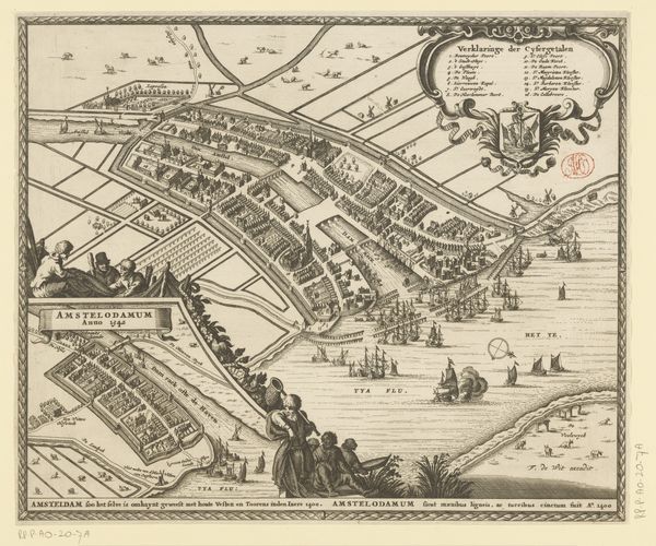
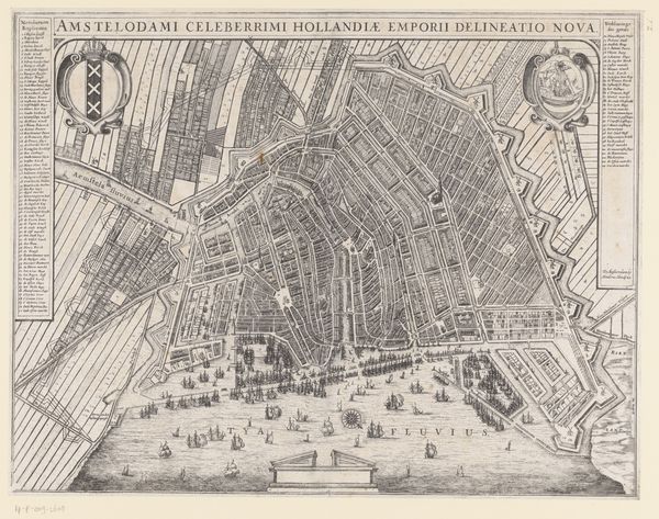
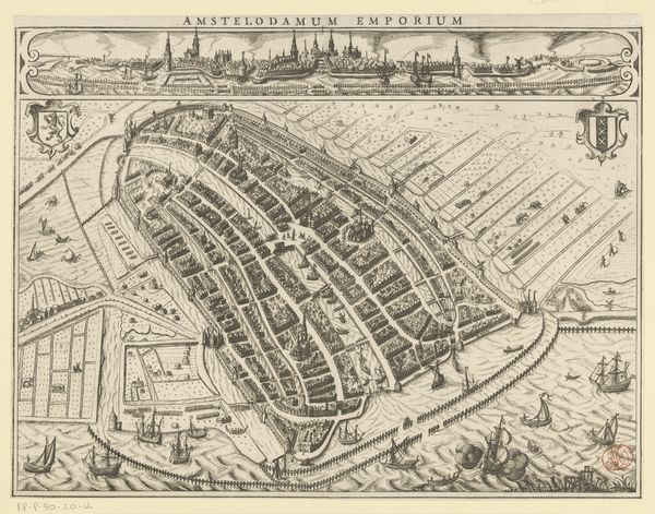
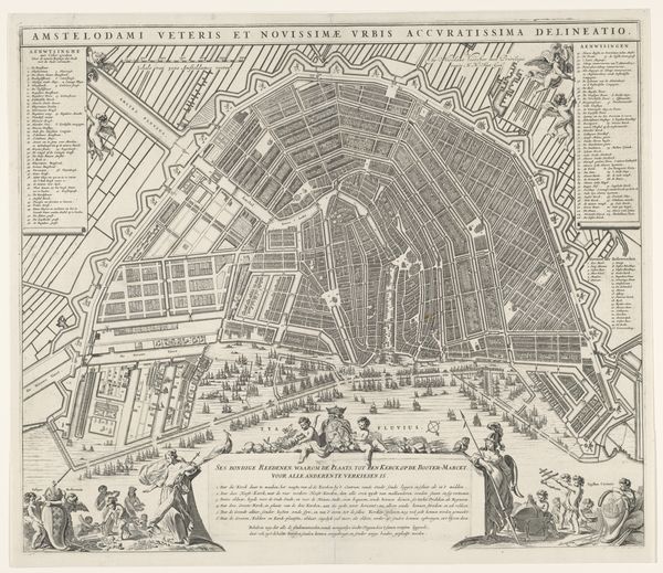
Curator: This meticulously rendered bird’s-eye view of Amsterdam from 1693 offers a captivating glimpse into the city’s past. Though attributed to an anonymous hand, the work, entitled "Plattegrond van Amsterdam, 1500," provides invaluable insights into the cityscape. The work itself is a print; likely an engraving using ink on laid paper. Editor: It's almost dizzying! The incredible detail, especially looking down those seemingly endless rows of buildings and canals, creates such a feeling of density. You can almost feel the hustle and bustle of this 17th-century Amsterdam from the boats sailing across the waters. Curator: Indeed. What’s fascinating is how it presents the city both as a structured, almost regimented space, but simultaneously highlights Amsterdam's thriving mercantile culture, particularly given the strategic significance of the harbor visible. I'm intrigued by how a historical map such as this actively served a cultural role, celebrating urban achievement. Editor: Right, and who did this representation serve? It reinforces the narrative of Dutch power and control—we see Amsterdam laid out as an orderly system of waterways and buildings, but not the undercurrents of social and economic inequalities. The map aestheticizes and simplifies lived experience for those who likely weren’t experiencing that prosperity equally. It feels as though there are hidden histories beneath these streets and docks that are being excluded here. Curator: Precisely! While ostensibly documenting the urban landscape, its very construction reflects the ambitions and ideologies of its time. This idealized image also invites comparison between its era's version of Amsterdam, with our current cityscape, tracing social progress, economic changes, and demographic evolution that contributed towards our reality now. Editor: It also begs the question, how was this understanding of cartography intertwined with colonization? I can't help but consider who was being mapped, and who was doing the mapping. So while we marvel at the intricate detail, we have to interrogate its purpose, its omissions, and how it participates in broader systems of power. I wonder how the waterways impact segregation and how the waterways contribute to power or exclusion. Curator: The tensions within representation is essential to understand art as active political agents that work in both ways—reflecting their historical context and actively constructing ideologies to reflect power, segregation, progress and so on. By understanding historical and cultural frameworks behind this, it offers visitors not only an engaging view on how cities evolve but also what remains from that past until now. Editor: Absolutely. For me, seeing art in terms of power means asking difficult questions about its role within society and challenging our own inherited perceptions. This piece invites us to see a snapshot of Amsterdam, yes, but also to question the narratives of order, progress, and prosperity that can mask complex lived realities and broader power dynamics.
Comments
No comments
Be the first to comment and join the conversation on the ultimate creative platform.
More like this