drawing, graphic-art, print, etching
#
drawing
#
graphic-art
# print
#
etching
#
etching
#
romanticism
Dimensions: height 249 mm, width 351 mm
Copyright: Rijks Museum: Open Domain
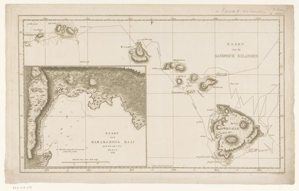
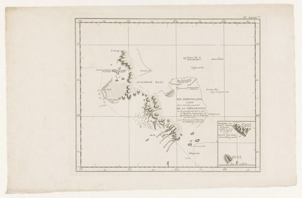
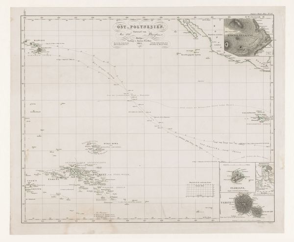
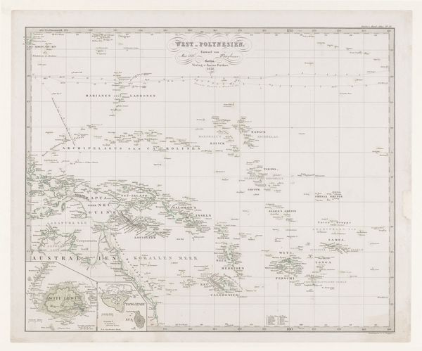
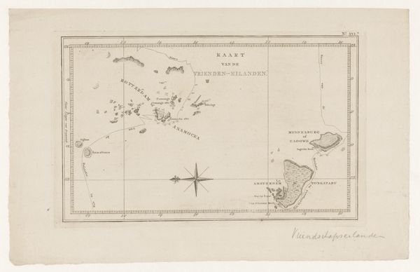
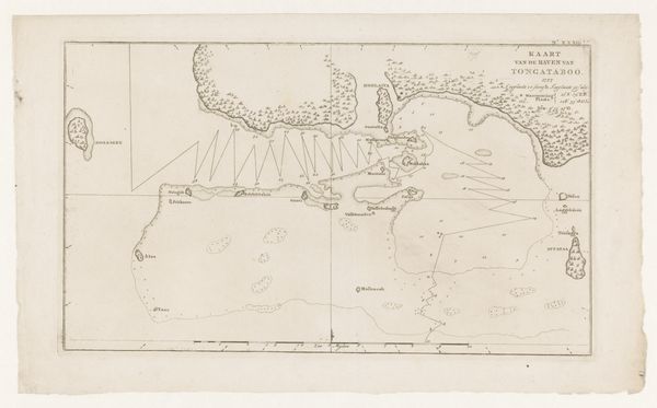
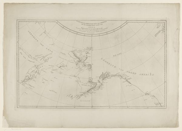
Curator: Here we have an etching titled "Kaart van de Tonga Archipel in Polynesië," or "Map of the Tonga Archipelago in Polynesia," created in 1801 by an anonymous artist. Editor: It’s visually quite striking, despite its age. The stark lines and delicate details evoke a sense of early scientific exploration—almost haunting, like an incomplete puzzle. Curator: As an etching, its creation involved covering a metal plate with a waxy, acid-resistant coating. The artist then scratched the design into the coating, exposing the metal. Immersing the plate in acid bit away at the exposed areas, creating recessed lines. Ink was applied, the surface wiped clean, and then pressed onto paper. It's a detailed, labor-intensive printmaking process. Editor: Exactly. This map presents the islands within a grid—a tool of colonialism and control attempting to rationalize and organize Indigenous land. Consider also the labor extracted both in producing and reading this document. This wasn't just an exercise in geography; it facilitated resource extraction and potentially exploitation of the Tongan people and their land. Curator: You're right. Maps are, indeed, never neutral. But there's also a beauty in its crafting—the precision of line, the delicacy in rendering the islands, which are tiny scattered shapes here. It reminds us that printmaking served various functions from scientific to political and even aesthetic. And what did those tasks consist of in reality? It involves skilled engravers and printers, their labour embedded into these ostensibly objective representations. Editor: Absolutely, we shouldn’t disregard the artist’s technical ability. But placing it into a broader historical and political narrative is critical. How the islands were represented – what information was included or omitted– carries significant implications. Curator: Right. Consider the map's purpose—charting territories during a period of increasing European presence in the Pacific. Its production depended on various actors in knowledge production and dissemination that facilitated these acts. Editor: Understanding the intent of those making and distributing maps provides insights into that colonial agenda, making maps less as documentation, and more as a calculated device, no? Curator: In examining the map itself as a produced commodity alongside understanding its geopolitical impacts we obtain a layered perspective on historical encounters in the Pacific. Editor: Indeed. Thinking about maps today—how their data continues shaping understanding, this examination fosters a critical engagement with representation.
Comments
No comments
Be the first to comment and join the conversation on the ultimate creative platform.
More like this