About this artwork
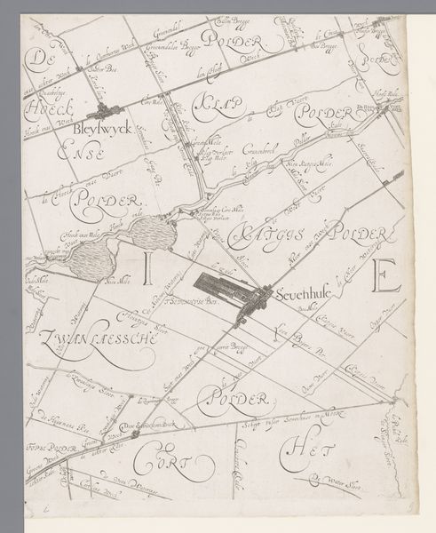
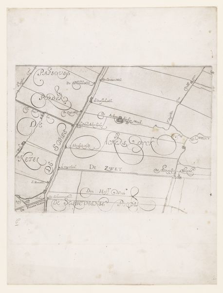
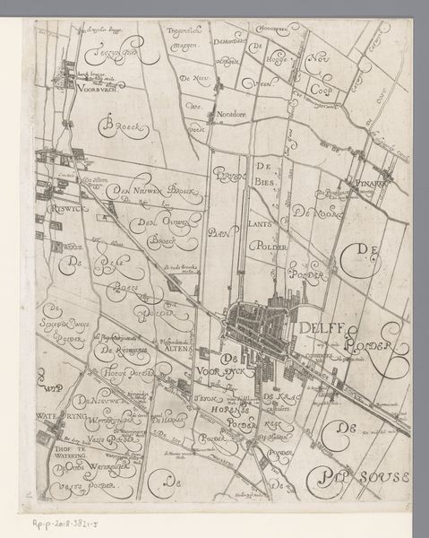
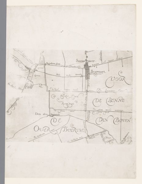
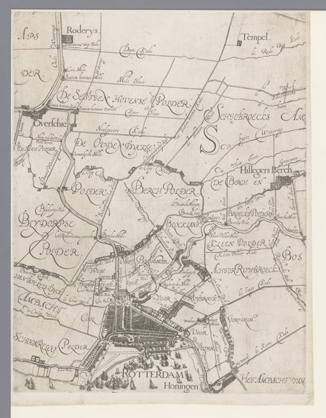
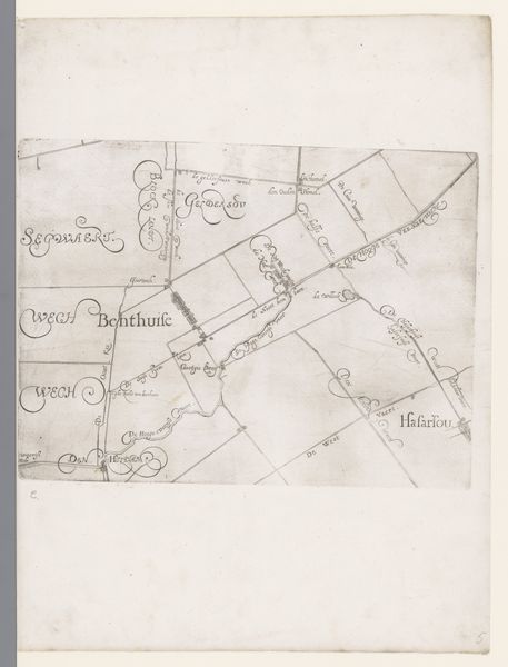
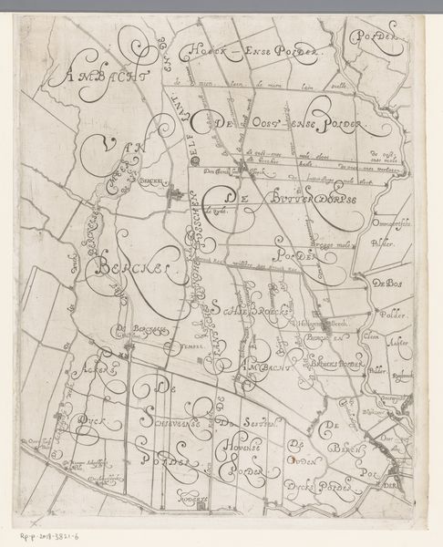
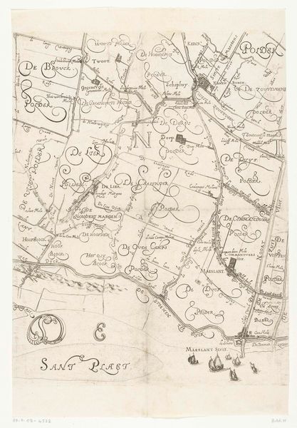
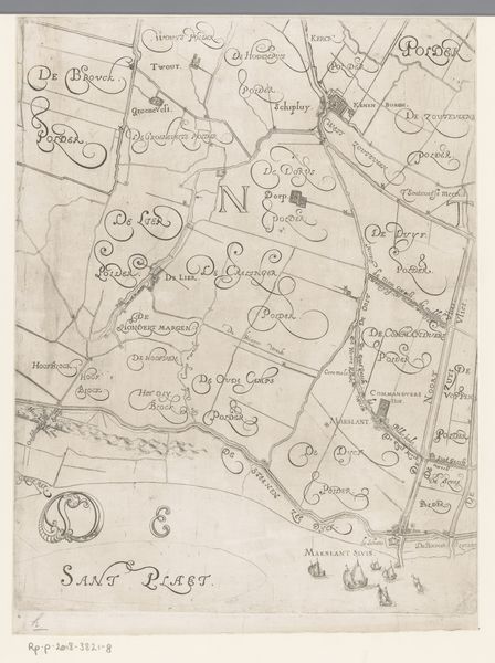
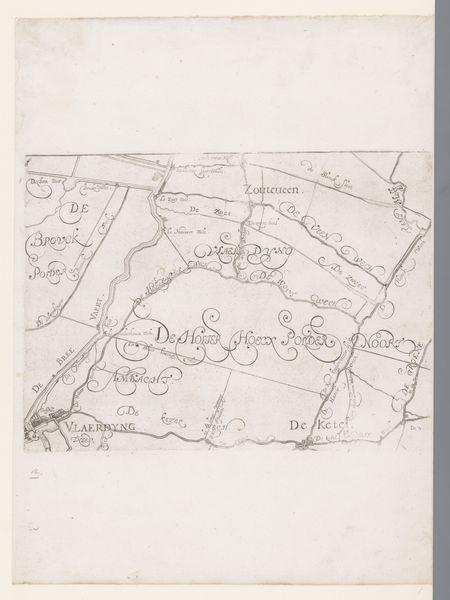
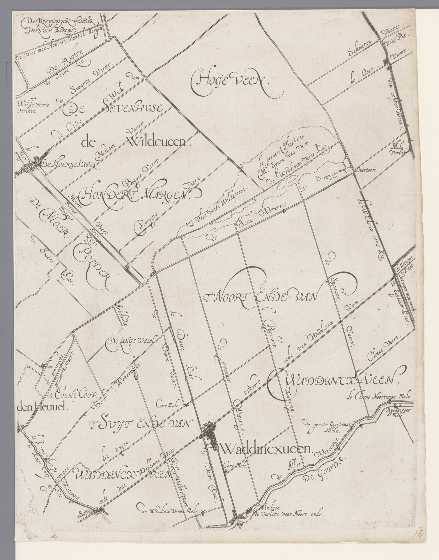
This map of the Hoogheemraadschap of Schieland, including Waddinxveen and Moerkapelle, was made by Floris Balthasarsz van Berckenrode, sometime around the turn of the 17th century. The map offers a unique insight into the complex relationship between the Dutch and their landscape. Schieland was, and remains, a region defined by its water management. The Hoogheemraadschap, or water board, was a powerful institution responsible for maintaining the intricate system of dikes, canals, and polders that made the low-lying lands habitable. The map emphasizes the artificiality of the landscape, and the enormous amount of planning and upkeep it required. Cartography during this period was not just a scientific endeavor but also an expression of power. By mapping and naming every canal, ditch and field the artist asserts a human claim over nature. It is a cultural document, reflecting the values and priorities of a society deeply invested in controlling its environment. To fully understand this map, one might consult archives of the Hoogheemraadschap, or study contemporary treatises on hydraulic engineering. The history of art is always contingent on the history of institutions.
Kaart van het Hoogheemraadschap van Schieland, met Waddinxveen en Moerkapelle
1611 - 1635
Floris Balthasarsz van Berckenrode
1562 - 1616Location
RijksmuseumArtwork details
- Medium
- drawing, paper, ink
- Dimensions
- height 390 mm, width 303 mm
- Location
- Rijksmuseum
- Copyright
- Rijks Museum: Open Domain
Tags
Comments
Share your thoughts
About this artwork
This map of the Hoogheemraadschap of Schieland, including Waddinxveen and Moerkapelle, was made by Floris Balthasarsz van Berckenrode, sometime around the turn of the 17th century. The map offers a unique insight into the complex relationship between the Dutch and their landscape. Schieland was, and remains, a region defined by its water management. The Hoogheemraadschap, or water board, was a powerful institution responsible for maintaining the intricate system of dikes, canals, and polders that made the low-lying lands habitable. The map emphasizes the artificiality of the landscape, and the enormous amount of planning and upkeep it required. Cartography during this period was not just a scientific endeavor but also an expression of power. By mapping and naming every canal, ditch and field the artist asserts a human claim over nature. It is a cultural document, reflecting the values and priorities of a society deeply invested in controlling its environment. To fully understand this map, one might consult archives of the Hoogheemraadschap, or study contemporary treatises on hydraulic engineering. The history of art is always contingent on the history of institutions.
Comments
Share your thoughts