drawing, print, paper, ink, engraving
#
drawing
#
aged paper
#
medieval
# print
#
pen sketch
#
sketch book
#
landscape
#
paper
#
personal sketchbook
#
ink
#
pen-ink sketch
#
ink colored
#
pen work
#
sketchbook drawing
#
cityscape
#
storyboard and sketchbook work
#
sketchbook art
#
engraving
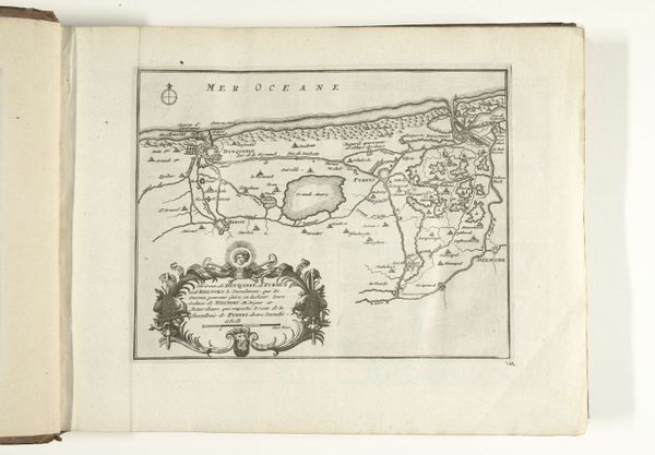
Dimensions: height 228 mm, width 288 mm
Copyright: Rijks Museum: Open Domain
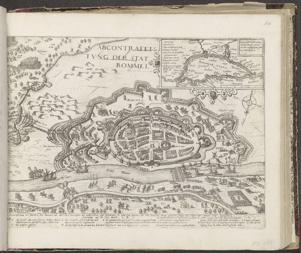
This is a map of the Strait of Gibraltar and Cadiz, dating from around 1693-1696, made by an anonymous artist. Executed in ink, the artwork presents two distinct cartographic views side by side. The composition reveals a clear intention to juxtapose geographical spaces, setting up a comparative visual study. The artist's use of line is meticulous, delineating coastlines and topographical features with precision. This suggests not just a geographical record, but also a way to engage with the intellectual milieu of the late 17th century. The arrangement of these maps within the frame invites us to consider the relationships between land, sea, and the burgeoning world of maritime exploration. The visual structure of the maps reflects a broader cultural project of organizing and understanding the world through observation and representation, challenging our notions of geographical certainty.
Comments
No comments
Be the first to comment and join the conversation on the ultimate creative platform.
More like this