drawing, print, etching
#
drawing
# print
#
etching
#
old engraving style
#
landscape
#
etching
#
geometric
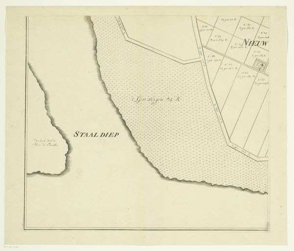
Dimensions: height 499 mm, width 567 mm
Copyright: Rijks Museum: Open Domain
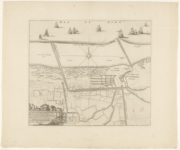
This map of Rozenburg Island was created by an anonymous maker, using ink on paper. The light, delicate lines and detailed lettering show a high degree of skill and precision. The material itself, paper, would have been relatively precious at the time, suggesting the map was commissioned for an important purpose, perhaps relating to land ownership or navigation. The island is meticulously divided into parcels, each with its own designation. This hints at a system of land management and economic activity. The presence of a compass rose and a sailing ship tells us about trade, exploration, and Rozenburg’s connection to the wider world. Consider the labor involved in creating such a map – the careful surveying, the meticulous drafting, the time taken to render each detail. This map is not just a representation of a place; it's a record of human activity, a testament to the skills and knowledge of its creator, and a window into the social and economic structures of its time.
Comments
No comments
Be the first to comment and join the conversation on the ultimate creative platform.
More like this