drawing, print, ink, engraving
drawing
baroque
pen sketch
landscape
ink
cityscape
engraving
Dimensions: height 387 mm, width 505 mm
Copyright: Rijks Museum: Open Domain
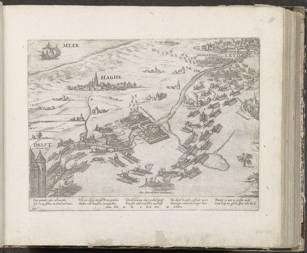
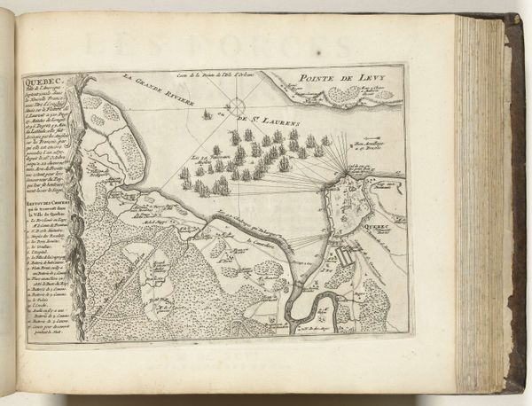
This map depicts the naval battle in the Bay of Vigo in 1702, created anonymously. It reflects the intense geopolitical rivalries of early 18th-century Europe. Consider the map not just as a record of geographical data, but as a political tool. How does it portray power, influence, and territorial claims? The detailed rendering of the battle serves to promote national pride and legitimize military action, but whose nation is promoted here? Produced in the Dutch Republic, this map would have been commissioned and consumed by a specific audience with particular interests and biases. The map may offer insight into the social, economic, and political dynamics of the period. It could tell us how information was disseminated, and how public opinion was shaped through visual media. By exploring archives, and period documents, and analyzing the map's symbolism, historians can reveal its complex layers of meaning and its place within a specific historical context.
Comments
No comments
Be the first to comment and join the conversation on the ultimate creative platform.