drawing, print, paper, ink, engraving
#
drawing
#
narrative-art
#
baroque
# print
#
landscape
#
paper
#
form
#
ink
#
geometric
#
line
#
cityscape
#
history-painting
#
engraving
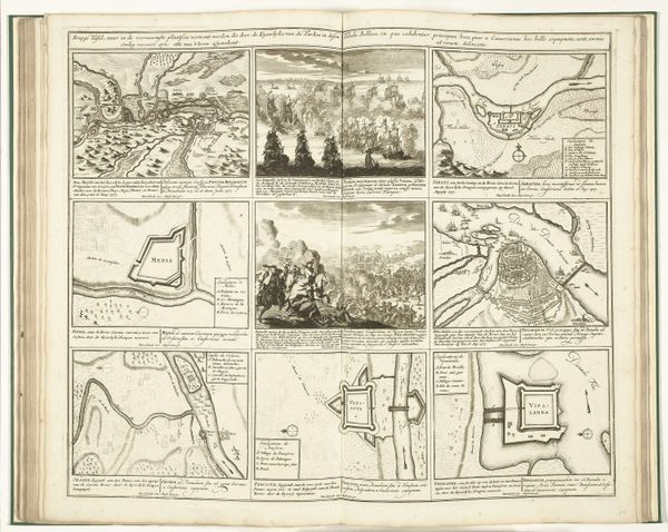
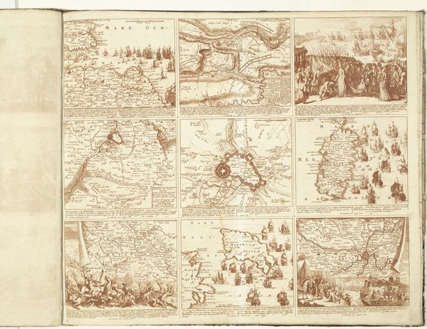
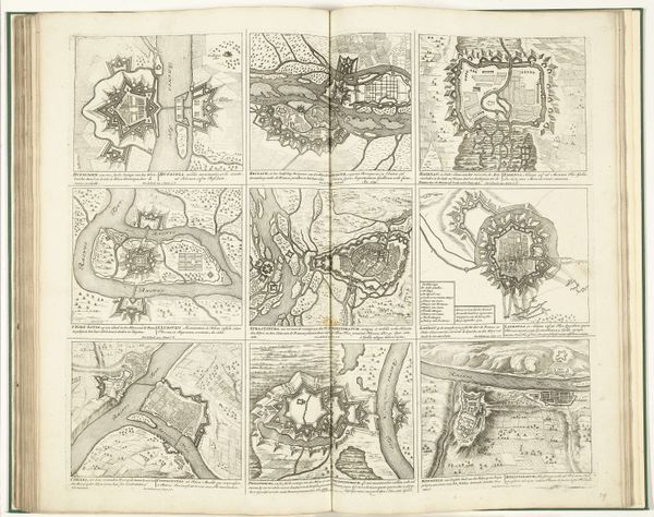
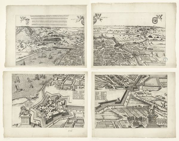
Dimensions: height 505 mm, width 585 mm
Copyright: Rijks Museum: Open Domain
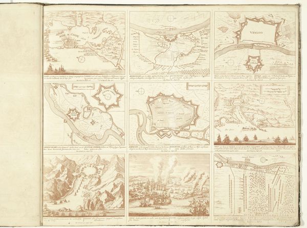
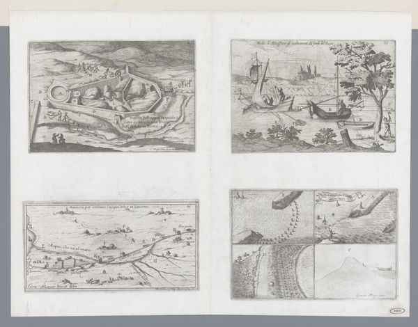
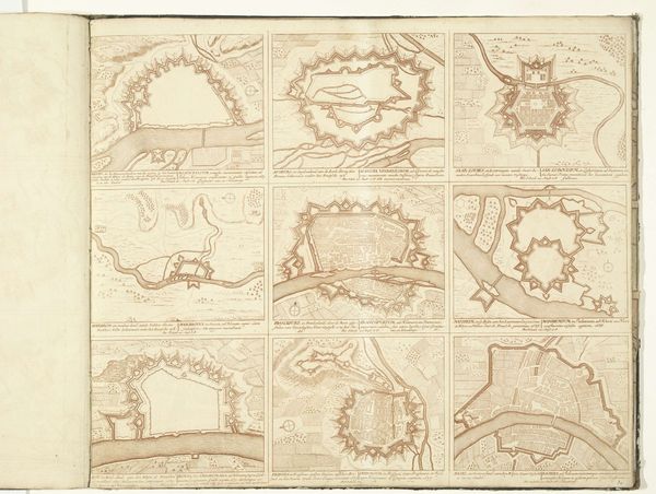
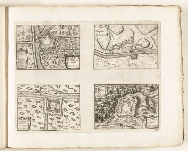
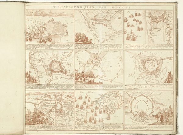
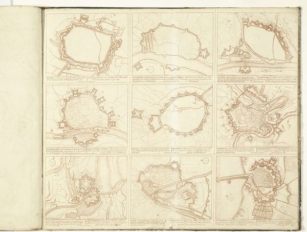
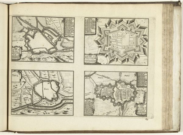
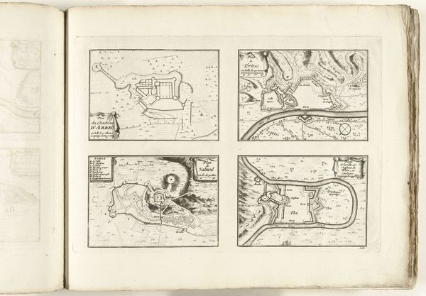
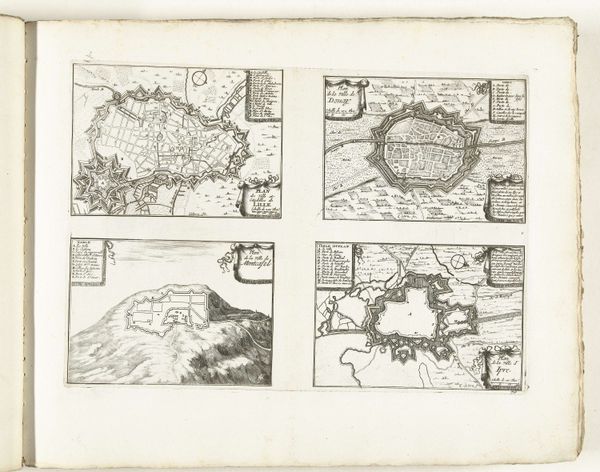
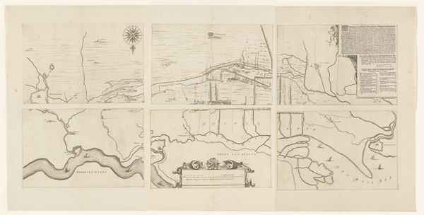
Curator: Pieter Schenk's print, "Schouwburg van den oorlog (blad IV)," likely created between 1703 and 1710, offers a fascinating visual record. These engravings, rendered in ink on paper, depict various battlefields and fortifications. What’s your first take on this sprawling layout? Editor: My initial impression is one of cool detachment. The overall sepia tone, coupled with the highly detailed, almost clinical rendering of battlefields, creates an eerie distance from the actual conflict. It’s war presented as geometry. Curator: Indeed. Schenk’s "Theater of War" presents the theater quite literally, as a staged setting for conflict. It’s important to remember the context; prints like these weren’t neutral records. They served political purposes, informing the public about ongoing wars and shaping perceptions of power and strategy. Editor: Absolutely. The consistent presence of star forts and siege lines carries immense symbolic weight. The geometric shapes evoke a sense of control and order, presenting war as a rational, calculated endeavor, despite its inherent chaos. There's also an implication of Roman-style mapping, further enhancing its symbolic dimension as an "epic." Curator: Furthermore, the level of detail suggests an informed perspective. These prints were likely based on military maps and intelligence, giving the viewer access to privileged information. It conveyed not only information but also the supposed rationale guiding geopolitical military actions to its contemporary viewer. Editor: I see that, but the sheer volume of intricate detail also points to a sort of visual overload, perhaps even a propagandistic effort to overwhelm the viewer into passive acceptance. Are we really meant to dissect each siege and fortification, or simply be impressed by the sheer scale of Dutch military reach? Curator: That's a crucial point. While offering detail, these maps certainly controlled access to true knowledge about such battlegrounds. By emphasizing strategic form over raw devastation, they helped craft the public view and also reinforced the government's military decisions. Editor: It becomes clear how these landscapes act almost as containers for encoded national identity, carefully managed and put on display for specific public consumption. Curator: Precisely, we begin to grasp that "Schouwburg van den oorlog (blad IV)" reveals just as much about image-making and socio-political positioning as it does about literal topography and strategic mapping. Editor: Looking closely really encourages one to remember art like this as part of complex historical moment, far beyond merely informational mapping.
Comments
No comments
Be the first to comment and join the conversation on the ultimate creative platform.
More like this