print, watercolor
#
baroque
# print
#
landscape
#
watercolor
#
coloured pencil
#
cityscape
#
watercolor
Dimensions: height 120 mm, width 152 mm
Copyright: Rijks Museum: Open Domain
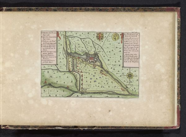
Zacharias Chatelain the second’s “Plattegrond van Haguenau” presents a bird's-eye view of the city, distinguished by its detailed geometric layout and subtle color palette. The city’s architecture and surrounding landscapes are methodically rendered, creating a sense of order and control. The map's structure employs a semiotic system, where each line, shape, and color acts as a signifier. The pale yellows and greens of the urban spaces contrast with the deeper greens of the fortifications, signaling both natural and constructed boundaries. Notice how this careful articulation of space and boundary reflects Enlightenment ideals of reason and order, typical of the period's representational strategies. Through the use of visual language, Chatelain transforms the physical space of Haguenau into a legible, almost abstract composition. This cartographic representation goes beyond mere documentation. It creates a structured view of the world, inviting us to consider how we organize and interpret our environment through art and science.
Comments
No comments
Be the first to comment and join the conversation on the ultimate creative platform.
More like this