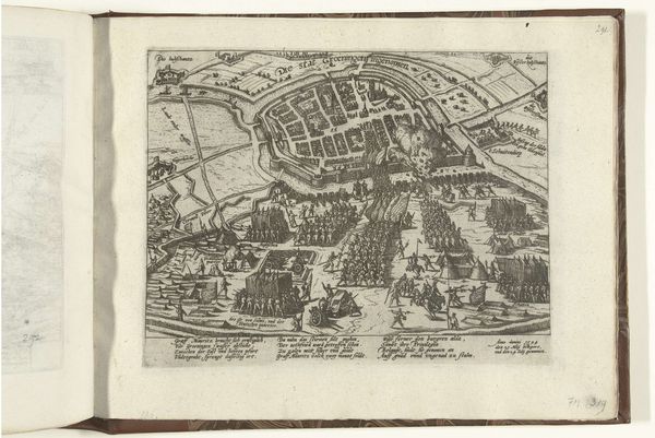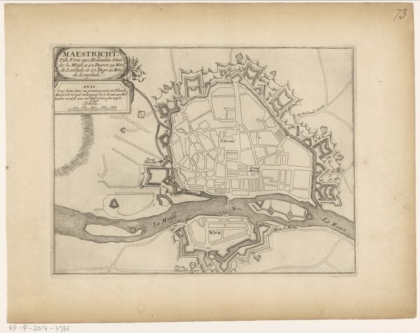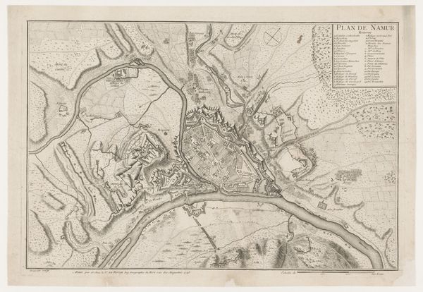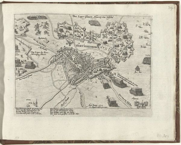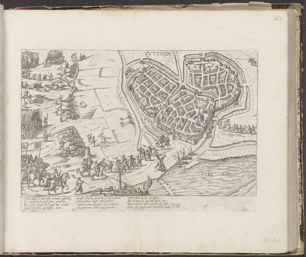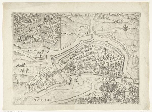
1612
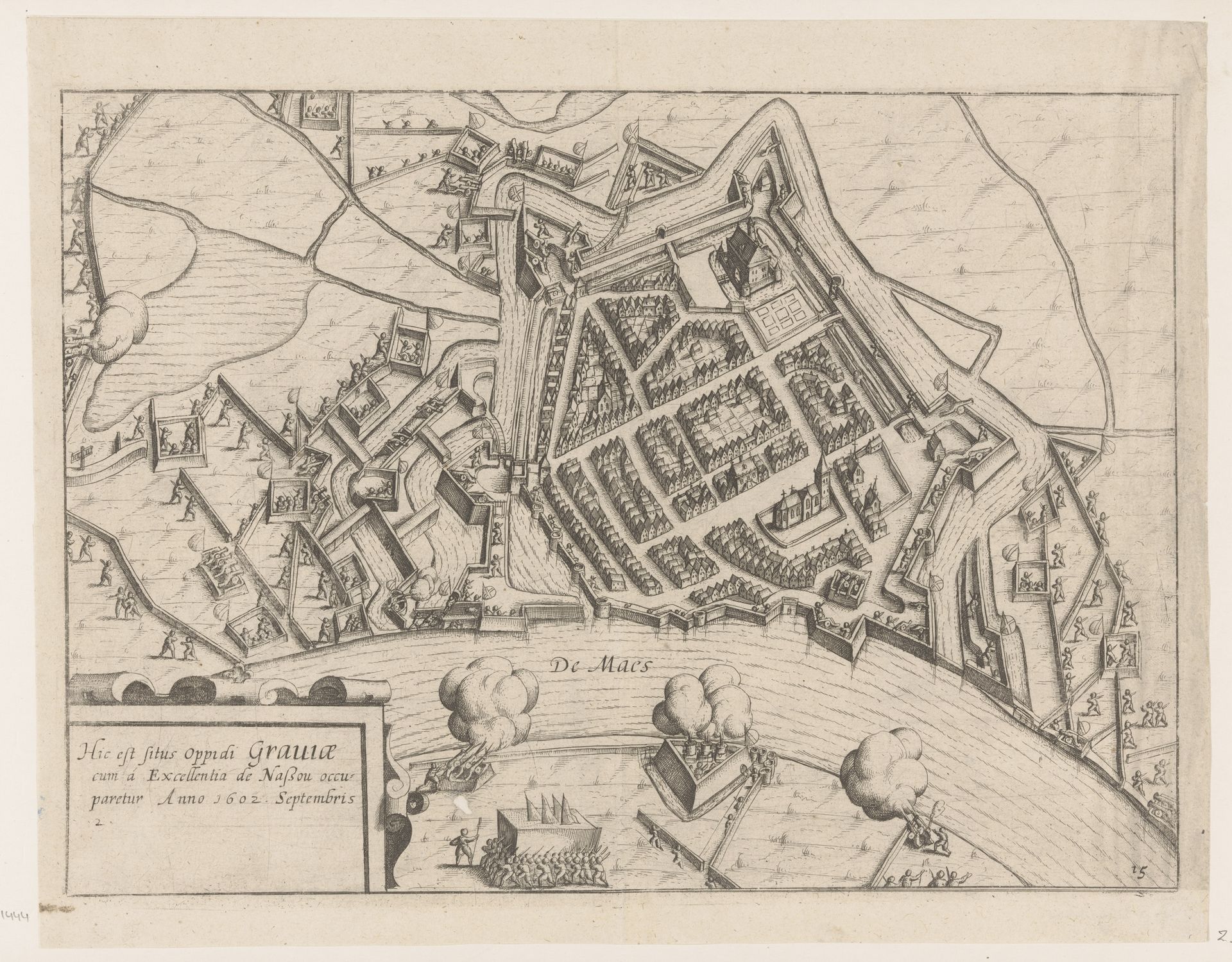
Plattegrond van de vesting en belegering van Grave
Lambert Cornelisz
1593 - 1621Location
RijksmuseumListen to curator's interpretation
Curatorial notes
Lambert Cornelisz created this print, "Plattegrond van de vesting en belegering van Grave," in 1602, presenting a bird's-eye view of the siege. It serves as both a practical record and a piece of propaganda. This detailed rendering of Grave, besieged by the forces of Maurice of Nassau, is a product of the Netherlands, a region then deeply embroiled in the Eighty Years' War. Consider the role of cartography at this time. Detailed maps were critical military tools, but also powerful symbols of ownership and control. This print underscores the importance of the siege of Grave, a key event in the Dutch struggle for independence from Spain. Note the plumes of smoke, the meticulously rendered fortifications, and the regimented layout of the city itself. It is a statement about power, technology and the emerging Dutch identity. To fully understand an image like this, we might consult military archives, period maps, and chronicles of the Eighty Years' War. Only then can we appreciate how art is inextricably linked to the political and social realities of its time.