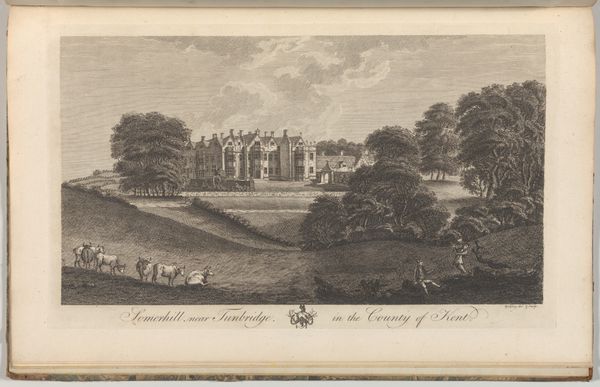
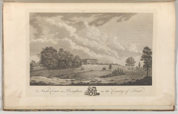
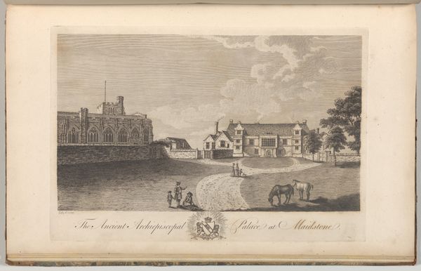
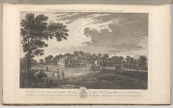
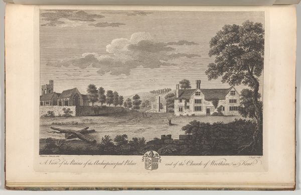
Ruins of the Ancient Archiepiscopal Palace at Otford in Kent, from Edward Hasted's, The History and Topographical Survey of the County of Kent, vols. 1-3 1777 - 1790
0:00
0:00
drawing, print, etching, engraving
#
drawing
# print
#
etching
#
landscape
#
cityscape
#
history-painting
#
engraving
Dimensions: Book: 17 5/16 × 11 × 13/16 in. (44 × 28 × 2 cm) Sheet: 16 15/16 × 10 5/8 in. (43 × 27 cm) Plate: 10 1/16 × 14 in. (25.5 × 35.5 cm)
Copyright: Public Domain
This is a black and white print from Edward Hasted's "History and Topographical Survey of the County of Kent", created by John Bayly in the late 18th century. At first glance, we see a picturesque scene of ruins, framed by trees and foliage. The image, however, destabilizes the traditional picturesque through the rigid geometry of the ruins, set against the softness of the landscape. Bayly uses line and form to create a composition that invites the viewer to contemplate the relationship between past and present. The structured decay of the palace is in stark contrast to the natural, organic growth surrounding it. This juxtaposition can be interpreted through the lens of structuralism, as it highlights binary oppositions: order versus chaos, human construction versus natural evolution. The print serves not just as a historical record but also as a meditation on time and change. The detailed rendering of the ruins forces us to confront the transience of human achievement against the enduring backdrop of nature. This engraving captures a moment in time, but it also embodies a larger cultural discourse about history, memory, and the sublime.
Comments
No comments
Be the first to comment and join the conversation on the ultimate creative platform.
More like this