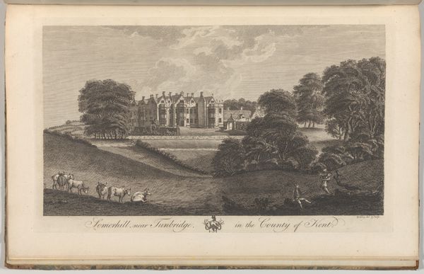
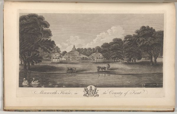
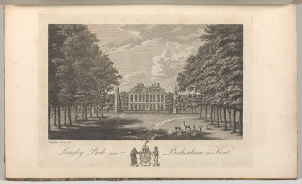
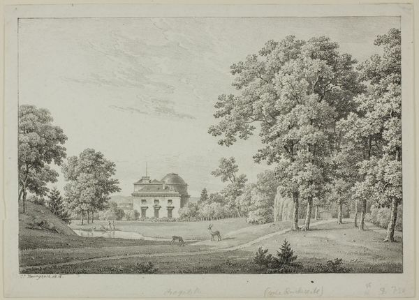
Somerhill, near Tunbridge, in the County of Kent, from Edward Hasted's, The History and Topographical Survey of the County of Kent, vols. 1-3 1777 - 1790
0:00
0:00
drawing, coloured-pencil, print, etching, intaglio, paper, engraving
#
photo of handprinted image
#
drawing
#
neoclacissism
#
toned paper
#
coloured-pencil
# print
#
etching
#
intaglio
#
landscape
#
paper
#
coloured pencil
#
history-painting
#
engraving
Dimensions: Book: 17 5/16 × 11 × 13/16 in. (44 × 28 × 2 cm) Sheet: 16 15/16 × 10 5/8 in. (43 × 27 cm) Plate: 10 1/16 × 14 in. (25.5 × 35.5 cm)
Copyright: Public Domain
This is an engraving of Somerhill House near Tunbridge, in Kent, made by Richard Bernard Godfrey as an illustration for Edward Hasted's "History and Topographical Survey of the County of Kent", likely sometime in the late 18th century. The image presents a picturesque view of a grand estate, complete with deer, swans, and a serene lake. These elements evoke an image of cultivated wealth and landed gentry, reflecting the social hierarchy of the time in England. The inclusion of this image in a topographical survey, a genre that flourished in the 18th century, speaks to the period's interest in documenting and celebrating the nation's estates and properties. These surveys served not only as historical records but also as assertions of ownership and social status. To fully understand this image, we need to consider the political economy of 18th-century England, where land ownership was synonymous with power. Researching the history of Somerhill House and the families who resided there would give us a clearer understanding of the social context in which this image was created and consumed.
Comments
No comments
Be the first to comment and join the conversation on the ultimate creative platform.
More like this