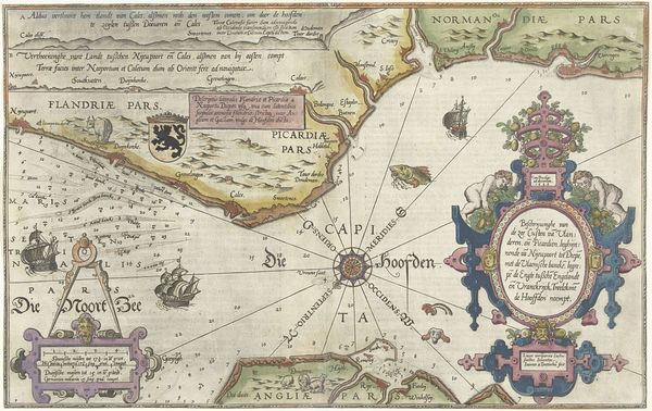
Map of South-East Coast of England and River Thames c. 17th century
0:00
0:00
Dimensions: 21 7/8 x 25 5/16"
Copyright: CC0 1.0
Editor: Here we have an anonymous map of the South-East Coast of England and River Thames, held at the Harvard Art Museums. I’m struck by how sparse the sea is, crisscrossed with lines. What can you tell me about it? Curator: The map's emptiness speaks volumes. It's not just about geographic representation, but about projecting power. These maps aided England's rise to naval dominance. Where would you place this historically based on the imagery? Editor: Well, the sailing ship suggests early exploration, maybe the 17th or 18th century? Curator: Precisely. These maps weren't neutral; they served colonial ambitions. The detail given to the Thames also reflects its importance for trade and governance. Editor: So, it's a political tool disguised as a geographical document. Curator: Exactly. It reminds us that even seemingly objective images are shaped by cultural and political agendas.
Comments
No comments
Be the first to comment and join the conversation on the ultimate creative platform.
More like this